Last updated 2026-07-25
TL;DR
Oscar Newman, an architect, coined "defensible space" in his 1972 book about crime prevention through building design, not fire. CAL FIRE adopted the term decades later for wildfire zones around homes (0-5 ft, 5-30 ft, 30-100 ft). Knowing the origin helps explain why the rules focus on ownership and control of space around a structure, more than vegetation removal.
who was oscar newman and what did he actually mean by "defensible space"?
Oscar Newman was an architect and urban planner who published "Defensible Space: Crime Prevention Through Urban Design" in 1972. He wasn't thinking about wildfire at all. His research looked at public housing projects in New York and other cities, trying to figure out why some buildings had high crime rates and others, built with similar budgets in similar neighborhoods, didn't. Newman's theory was that physical design shapes behavior. If residents can see and feel ownership over the space around their building (a stoop, a shared yard, a lobby with sightlines), they act like it's theirs, they watch it, and criminals avoid it. If the space is anonymous, unowned, and disconnected from any specific resident, nobody defends it and crime moves in. He called that ownership-through-design concept "defensible space." So the term you see on CAL FIRE brochures and insurance inspection letters today is a borrowed phrase. Wildfire agencies picked it up starting in the 1970s and 1980s because the core idea transfers surprisingly well: a homeowner who actively manages and controls the space immediately around their house (clearing debris, spacing vegetation, hardening the structure) creates a zone that resists an oncoming threat, whether that threat is a burglar or a fire front. The mechanism is completely different, but the framing, that you have to actively claim and maintain the space around your home rather than treat it as passive background, carried over cleanly. This matters for homeowners right now because it explains something confusing about the current rules. Defensible space law isn't really about aesthetics or even primarily about fuel load in the abstract. It's about creating a zone you control, checked, verified, and documented, that a fire behaves predictably in. That's a very Newman idea, just applied to embers instead of intruders.
when does the california defensible space law go into effect?
California's core defensible space requirement, the 100-foot clearance rule around structures in State Responsibility Areas and designated wildland-urban interface zones, has been in effect since 2005 under Public Resources Code Section 4291 [1]. It's not new. What is newer, and what's causing confusion in 2024-2026, is the added "ember-resistant zone" (Zone 0) requirement. Assembly Bill 3074 (2020) directed CAL FIRE and the Board of Forestry to develop regulations for a 0-5 foot ember-resistant zone immediately around structures [2]. As of early 2025, the Board of Forestry and Fire Protection had not yet finalized and adopted the Zone 0 regulation, meaning it was still in rulemaking rather than enforceable statewide law. Check the Board of Forestry's current rulemaking page directly before you assume a specific effective date, because this has moved multiple times and local fire districts may adopt stricter versions in the interim (guided fill-in: [confirm current status with your local fire district or CAL FIRE unit]). The existing, already-enforceable law is clearer: PRC 4291 requires defensible space out to 100 feet from structures (or to the property line, whichever is closer) in SRA and designated areas, broken into two zones, 0-30 feet ("lean, clean, and green") and 30-100 feet (reduced fuel, not bare dirt) [1]. If you got a non-renewal or inspection letter citing defensible space, it's almost certainly this statute, not the still-pending Zone 0 rule.
what fire-safe home rules take effect in 2026?
This is the most common confused search right now, and the honest answer is: it depends on which state and which specific rule, because several overlapping deadlines cluster around 2025-2026. There is no single national "2026 fire-safe homes law." In California, the Zone 0 ember-resistant space regulation is the one most people mean when they ask this. CAL FIRE's own guidance describes Zone 0 as the area within 5 feet of a structure where no combustible materials, mulch, or vegetation should be present [3]. As of this writing the regulation has been through multiple public comment cycles; homeowners should check the Board of Forestry and Fire Protection's active rulemaking docket for the current adoption and compliance timeline rather than relying on a fixed date, since it has already slipped past earlier target years. Separately, some insurers and FAIR Plans have started requiring proof of defensible space compliance and, in some cases, home hardening features (ember-resistant vents, Class A roofing) as a condition of new policies or renewals, independent of when the state regulation formally takes effect. That's a private underwriting decision, not a public law, and it varies company by company. Colorado, Oregon, and Arizona each have their own timelines. Oregon's statewide wildfire risk map and defensible space code requirements, tied to Senate Bill 762 (2021), went through a contentious rollout and were revised after public pushback; check Oregon Department of Forestry's current wildfire risk map page for the live status in your area [3]. Colorado doesn't have one statewide defensible space statute the way California does; it's largely county and fire-district level, so [confirm your specific county wildfire mitigation ordinance] is the honest instruction there, not a blanket date.
why won't people follow the defensible space law in california?
Compliance with PRC 4291 is genuinely low in many high-risk areas, and it's worth being honest about why, because "people are lazy" is a lazy answer. Cost is the biggest factor. Clearing 100 feet of vegetation on a sloped, wooded lot isn't a weekend project. Depending on lot size, terrain, and vegetation density, professional clearing can run from several hundred dollars for a small flat lot to several thousand for a large, steep, brush-heavy parcel, and it's not a one-time expense; it has to be redone annually or biannually as vegetation regrows. For a retiree on a fixed income in the Sierra foothills, that recurring bill competes with property taxes and everything else. Second, enforcement has historically been inconsistent. CAL FIRE and local fire agencies conduct inspections, but the ratio of inspectors to parcels in SRA zones is thin, and a citation doesn't always follow a failed inspection; often it's a re-inspection notice with more time. Homeowners learn, correctly or not, that the practical consequence of non-compliance is low until an insurer, not the state, enforces it by dropping coverage. Third, there's a genuine information gap about what "compliant" looks like. The statute language ("lean, clean, and green" in zone one, reduced fuel load in zone two) is qualitative, not a checklist with measurements, and different inspectors interpret it differently. A homeowner who cleared what they thought was sufficient can still fail an inspection, which breeds resentment and inconsistent follow-through. Fourth, and this is understated: some homeowners genuinely value the tree cover, privacy, or habitat that clearing removes, and they're making a values trade-off, more than skipping a chore. None of that changes the fire physics, but it explains the behavior.
how to prevent wildfires around your own property
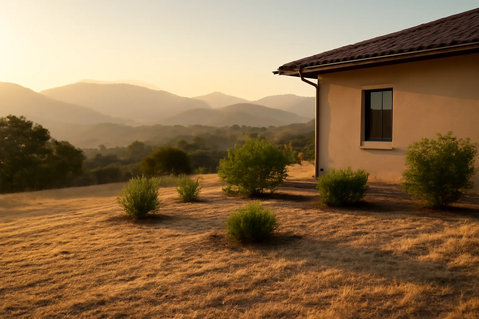
You can't prevent wildfire ignition from lightning or a downed power line, but you have real control over whether a fire that reaches your property becomes a structure loss. The research consensus, driven largely by the Institute for Business & Home Safety and USDA Forest Service fire behavior studies, is that ember exposure, not direct flame contact, causes most home losses in wildland-urban interface fires. That reframes prevention at the property level into three concrete actions. First, eliminate ignition points within 5 feet of the structure: no mulch, no stored firewood, no dry vegetation touching siding. Second, maintain the 5-30 foot zone with well-spaced, low, irrigated plants and no ladder fuels (vegetation that lets fire climb from ground to shrub to tree canopy). Third, harden the structure itself: ember-resistant vents, a Class A fire-rated roof, and enclosed eaves matter more than most homeowners assume, because embers entering attic vents or roof gaps is one of the most common ignition pathways documented in post-fire damage assessments. For a full breakdown of what goes in each zone by distance from the house, see fire safe landscaping in California next to the house, and for the structure-hardening side specifically, defensible covers vent and roofing priorities in more depth. CAL FIRE's own framing is direct: "Defensible space is the buffer you create between a building on your property and the grass, trees, shrubs, or any wildland area that surrounds it". That buffer is what gives firefighters a place to work and reduces the chance embers find fuel against your walls.
how to prepare for a wildfire before it happens
Preparation splits into two tracks that people often conflate: property-level mitigation (the defensible space and hardening work above) and household evacuation readiness. Both matter, and insurers increasingly want to see documentation of both. For evacuation readiness, Ready.gov recommends assembling a go-bag with at least a three-day supply of food and water per person, copies of insurance policies and identification, medications, and a battery-powered radio [4]. Ready.gov also recommends signing up for your county's emergency alert system before fire season, not during it, since some systems require manual enrollment. For property documentation, before any fire season starts, walk your property and photograph or video every defensible space zone, your roof, vents, siding, and any recent clearing or hardening work you've done. Date-stamp it. This isn't about proving anything to a fire agency; it's about having your own record if you ever need to show an insurer what condition your property was in, independent of whatever the adjuster's field notes say. This is also the kind of documentation homeowners assemble in a Wildfire Insurance Survival Kit, a one-time $99 tool for organizing property photos, mitigation records, and inventory documentation into a format that's ready to send if you're notified of non-renewal or need to file a claim. To be clear: this doesn't file claims or contact your insurer for you; it's a documentation tool you use yourself. Ready.gov's wildfire-specific page also recommends having an evacuation plan with two routes out of your neighborhood, since fire can block a single route quickly [4].
how to prevent forest fires and how to avoid forest fires
These are really two different questions wearing the same words. "Preventing forest fires" at the landscape level is mostly about ignition sources, since the vast majority of wildfires in the US are human-caused, not lightning-caused, according to National Interagency Fire Center data cited by CAL FIRE's own prevention materials [5]. Debris burning, equipment sparks, unattended campfires, and dragging trailer chains are the recurring culprits. At the individual level, the actionable version of "prevent forest fires" is: fully extinguish campfires (drown, stir, drown again, until cold to the touch), don't park or idle vehicles on dry grass (catalytic converters run over 500°F and are a documented ignition source), maintain equipment with spark arrestors if you're using chainsaws or off-road vehicles in wildland areas, and check local burn permit status before any debris burning, since permit suspensions during red flag conditions are common and enforced. "Avoiding" forest fires, as in staying safe from one that's already started, is a different skill: know your area's evacuation zone designation, keep your gas tank above half during fire season, and don't wait for a mandatory evacuation order if conditions look bad; voluntary early evacuation is what fire officials consistently ask for because it keeps roads clear for later mandatory evacuees and emergency vehicles. The Smokey Bear campaign line, "Only you can prevent forest fires," oversimplifies this into a slogan, but the underlying data point holds: most ignitions are within human control. For more on how that framing has shaped public policy, see only you can prevent wildfires.
is santa barbara safe from fire?
No part of Santa Barbara County is fully safe from wildfire risk, and the county's own recent history makes that concrete rather than abstract. The Thomas Fire (December 2017) burned over 281,000 acres and was, at the time, the largest wildfire in modern California history; it was followed within weeks by the Montecito debris flow, which killed 23 people when burn-scarred hillsides failed during heavy rain [6]. The Jesusita Fire (2009) burned into the city's foothill neighborhoods directly, destroying dozens of homes in the Mission Canyon and Riviera areas. CAL FIRE's Fire Hazard Severity Zone maps classify large portions of Santa Barbara County's foothill and mountain-adjacent neighborhoods (the areas nearest the Santa Ynez range) as Very High or High fire hazard severity zones [7]. Lower, flatter areas closer to the coast and downtown carry substantially lower designated risk, but "lower risk" is not "no risk," particularly given how wind-driven fires in this region (sundowner winds specifically) have historically crossed considerable distances. If you own property in Santa Barbara's WUI-adjacent neighborhoods, the honest framing is: your risk depends heavily on which specific zone your parcel sits in, so check your address against CAL FIRE's current Fire Hazard Severity Zone viewer rather than relying on a citywide answer, and confirm your local fire district's specific defensible space enforcement schedule, since Santa Barbara County Fire Department may have inspection cycles and clearance specifics beyond the state minimum. [Confirm with Santa Barbara County Fire Department's current defensible space inspection program for parcel-specific requirements.]
how does the newman framework explain modern insurance non-renewals?
Insurers didn't invent the defensible space concept; they adopted it as a proxy for risk, the same way CAL FIRE adopted it as a proxy for structure survivability. But the underwriting logic tracks Newman's original idea more closely than people realize. Newman's argument was that unmanaged, ownerless space invites the bad outcome. An insurer looking at aerial imagery of your parcel (most major carriers and FAIR Plans now use aerial and satellite vegetation analysis as part of underwriting, a practice several state insurance departments have scrutinized for accuracy) is making a version of the same judgment: does this space look actively managed, or does it look abandoned to whatever grows there? A cleared, maintained zone around the structure reads as "defended." An overgrown lot reads as undefended, regardless of what's actually inside the house. This is why documentation matters so much for homeowners fighting a non-renewal. If your defensible space work isn't visible in whatever imagery or inspection data the insurer used, or if it was done after the imagery date, you have a real, fixable communication problem, not necessarily a risk problem. Photographing your cleared zones, keeping receipts for contractor clearing work, and keeping dated records of hardening improvements (new vents, roof replacement) gives you something concrete to send if you're contesting a non-renewal determination or want to demonstrate current condition. You send this yourself; no third party can guarantee it changes an outcome. For related state-specific mitigation and contractor documentation approaches, see wildfire defensible space clearing contracts in Washington State (DNR), which covers how one state structures cost-share and contractor verification, a model other states are watching.
how to prepare for forest fires as a household, more than a property
Property mitigation gets most of the attention, but household-level preparation is the part that actually determines what happens to your family in the first ten minutes of an evacuation order. FEMA and Ready.gov both recommend a written family communication plan that includes an out-of-area contact, since local phone networks can be overloaded during a regional evacuation [4]. Practical steps worth doing before fire season, not during it: know two ways out of your neighborhood by car; keep a paper copy of your emergency contacts and insurance information (digital access fails when power and cell towers go down); if you have livestock or large animals, pre-arrange an evacuation location, since many county fairgrounds and equestrian centers offer this but fill up fast during active fires; and if you or a family member has a mobility limitation, register with your county's disability and access needs registry if one exists, since many California counties maintain these specifically for emergency response prioritization. The overlooked piece is financial preparation: know your policy's coverage for temporary housing (Additional Living Expenses / Loss of Use) before you need it, and understand your deductible structure, since some wildfire policies in high-risk zones carry separate, higher wildfire-specific deductibles than the standard peril deductible. That's a conversation to have with your agent before a fire, not during a claim.
how can we prevent forest fires at the community level?
Individual defensible space work matters less if your neighbor's untreated lot sits 40 feet from your property line, which is why California's more effective wildfire risk reduction programs work at the community scale, more than the parcel scale. Firewise USA, a program run by the National Fire Protection Association, organizes neighborhoods into recognized "Firewise Communities" that coordinate defensible space work, share cost for chipper days and green waste disposal, and conduct joint risk assessments; NFPA data shows recognized Firewise communities numbering over 1,500 nationally as of recent program reporting . The value isn't symbolic: coordinated clearing closes the gaps between individual parcels that a single homeowner can't fix alone, since fire doesn't stop at a property line. County-level Community Wildfire Protection Plans (CWPPs), required under the federal Healthy Forests Restoration Act of 2003 for communities seeking certain federal fuel-reduction funding priority, identify high-risk areas and coordinate fuel breaks, evacuation route clearing, and water source access for firefighting equipment . If your county has an active CWPP, it's public and worth reading, since it tells you where your neighborhood ranks in the county's own risk assessment, which is often more specific and locally grounded than a statewide hazard map. The unglamorous truth is that community-level prevention (shared chipper programs, coordinated roadside clearing, prescribed burns done by qualified crews) moves the needle more than any single homeowner's 100-foot zone, because embers travel far past any one property's boundary. If you're the only cleared lot on your street, you've reduced your own risk, but not by as much as you'd think.
Frequently asked questions
When does the California defensible space law go into effect?
The core 100-foot defensible space requirement under Public Resources Code Section 4291 has been law since 2005. The newer Zone 0 (0-5 foot ember-resistant zone) requirement from Assembly Bill 3074 is still moving through Board of Forestry rulemaking as of early 2025; check the Board's current rulemaking status before assuming it's already enforceable in your area.
Why won't people follow California's defensible space law?
Cost, inconsistent enforcement, unclear qualitative standards, and in some cases a genuine preference for tree cover over clearing all contribute. Clearing 100 feet on a sloped, brush-heavy lot can cost thousands and needs redoing annually, while historically the practical consequence of non-compliance has often been a re-inspection notice rather than a citation.
How to prevent wildfires around a home?
Remove all combustibles within 5 feet of the structure, maintain well-spaced irrigated vegetation from 5-30 feet with no ladder fuels, and harden the structure itself with ember-resistant vents and a Class A roof. Most home losses in WUI fires come from ember ignition, not direct flame contact, according to fire behavior research from IBHS and the USDA Forest Service.
How do you prepare for a wildfire?
Do both property mitigation (defensible space, vent and roof hardening) and household readiness: a go-bag with three days of supplies, two evacuation routes, a family communication plan with an out-of-area contact, and photographed, dated documentation of your property's condition and mitigation work, per Ready.gov guidance.
How can individuals help prevent forest fires?
Fully extinguish campfires until cold to the touch, avoid parking on dry grass (hot catalytic converters are a documented ignition source), maintain spark arrestors on equipment, and check local burn permit status before debris burning. Most wildfires in the US are human-caused, not lightning-caused, per National Interagency Fire Center data.
How do you avoid a forest fire once one has started nearby?
Know your evacuation zone designation before fire season starts, keep your gas tank above half during high-risk months, and leave early rather than waiting for a mandatory order. Fire officials consistently ask for early voluntary evacuation because it keeps roads clear for people evacuating later under mandatory orders.
What fire-safe home rules take effect in 2026?
There's no single national 2026 rule. California's Zone 0 ember-resistant space regulation is the closest match to this question but hasn't been finalized with a fixed statewide compliance date as of early 2025; check the Board of Forestry and Fire Protection's active rulemaking page. Oregon, Colorado, and Arizona each run separate timelines at the state or county level.
Is Santa Barbara safe from fire?
No, not fully. Foothill neighborhoods near the Santa Ynez range carry Very High or High Fire Hazard Severity Zone designations from CAL FIRE, and the county experienced the 281,000-acre Thomas Fire in 2017 followed by a fatal debris flow. Risk varies significantly by specific neighborhood, so check CAL FIRE's hazard zone viewer for your address.
Who was Oscar Newman and why is his name on wildfire content?
Oscar Newman was an architect who coined "defensible space" in a 1972 book about crime prevention through building design, not fire science. Wildfire agencies borrowed the term decades later because the core idea, that actively controlled space around a structure resists an external threat, applied cleanly to embers as well as intruders.
What's the difference between Zone 0, Zone 1, and Zone 2 in defensible space?
Zone 0 (0-5 feet from the structure) requires no combustibles and is still in California rulemaking, not yet statewide law. Zone 1 (5-30 feet) requires "lean, clean, and green" low-fuel landscaping. Zone 2 (30-100 feet) requires reduced fuel load, not bare dirt, under Public Resources Code Section 4291.
Does clearing defensible space guarantee my insurance won't be non-renewed?
No. Defensible space compliance reduces risk and gives you documentation to show an insurer, but no mitigation work guarantees renewal or a rate change; that decision is made by the carrier's underwriting criteria. Documenting your work yourself is the most concrete step available; nobody can promise an outcome on your behalf.
What's a Community Wildfire Protection Plan and does my county have one?
A CWPP is a county-level plan, authorized under the federal Healthy Forests Restoration Act of 2003, identifying high-risk areas and coordinating fuel breaks and evacuation route clearing. Many counties in fire-prone states have one publicly posted; check your county's fire department or planning department site directly.
Sources
- California Public Resources Code Section 4291: 100-foot defensible space clearance requirement around structures in State Responsibility Areas, in effect since 2005
- California Legislature, Assembly Bill 3074 (2020): directed CAL FIRE and Board of Forestry to develop ember-resistant Zone 0 regulations
- CAL FIRE, Defensible Space Zone 0: definition of Zone 0 as area within 5 feet of structure requiring no combustible materials
- CAL FIRE, Thomas Fire incident record: Thomas Fire burned over 281,000 acres in December 2017
- CAL FIRE, Fire Hazard Severity Zone Maps: Fire Hazard Severity Zone classifications for Santa Barbara County foothill neighborhoods
- National Fire Protection Association, Firewise USA: Firewise USA program recognizing over 1,500 participating communities nationally
- Healthy Forests Restoration Act of 2003: federal statute establishing Community Wildfire Protection Plan framework and fuel-reduction funding priority