Last updated 2026-07-25
TL;DR
A wildfire landscape mitigation planner breaks your property into zones (0-5 ft, 5-30 ft, 30-100 ft) and assigns specific work to each: noncombustible material next to the house, spaced and pruned plants further out, and thinned trees at the perimeter. California's zone 0 ember-resistant rule is written into law but enforcement dates keep slipping; check your local fire district before assuming it's active.
What is a wildfire landscape mitigation planner and why do I need one
A wildfire landscape mitigation planner is just a structured way to walk your property zone by zone and decide what has to change before the next inspection, renewal, or fire season. It's not a single document you buy. It's a process: measure the zones around your house, list what's in each one, compare it against your state's defensible space standard, and write down what you'll fix and by when. If you got a non-renewal notice or a wildfire risk inspection letter, this matters more than it sounds. Insurers and state FAIR Plans increasingly use satellite and aerial imagery to score defensible space before they decide whether to renew you, and vegetation touching the structure or overhanging the roof is one of the most common flags. CAL FIRE's defensible space standard requires "a minimum of 100 feet of defensible space around structures" measured from the structure outward, or to the property line, whichever comes first. A planner turns that legal minimum into a task list you can actually execute over a weekend, a season, or a year, depending on budget. Most homeowners do this in phases: the 5-foot zone first (cheapest, highest fire-risk reduction per dollar), then the 30-foot zone, then the 100-foot zone if you have the land and the crew budget. For the home-hardening side of this (roof, vents, siding, decks) rather than the landscape side, see fire safe landscaping California next to house.
When does the California defensible space law go into effect
California's baseline 100-foot defensible space law (Public Resources Code 4291) has been in effect since 2005 and applies statewide in State Responsibility Areas and designated Wildland-Urban Interface zones [1]. What's newer, and still not fully in effect, is the "Zone 0" ember-resistant zone rule for the first 5 feet around a structure. Assembly Bill 3074 (2020) directed the Board of Forestry and Fire Protection to develop regulations for an ember-resistant zone within 5 feet of structures. The Board finalized draft regulations, and as of the most recent public updates, CAL FIRE and the Board of Forestry have been working through the formal rulemaking process with an anticipated effective date that has been repeatedly pushed back. Check CAL FIRE's defensible space page directly before you assume Zone 0 is enforceable in your area, because implementation timing differs from the statute's passage date. Here's the honest state of things: the law exists on paper, but many local fire agencies are still using the pre-2020 zone standards for inspections because the Zone 0 regulations require local adoption or state finalization first. Don't wait for enforcement to start the work. Insurers are already scoring defensible space using their own criteria, and Zone 0-style clearance (no bark mulch, no combustible plants, no wood fencing attached to the house within 5 feet) is what most underwriting models reward regardless of whether it's legally mandated yet in your county. If your fire district has already adopted stricter local rules, note them here: ___[fill in your local fire district's current Zone 0 or defensible space ordinance and effective date]___.
What fire-safe home rules take effect in 2026
The most concrete 2026-adjacent deadline homeowners ask about is tied to California's Zone 0 ember-resistant zone regulations, which the Board of Forestry and Fire Protection has targeted for phased effect, starting with new construction in high and very high fire hazard severity zones before extending to existing homes. Timelines have shifted more than once, so treat any specific 2026 date as provisional until CAL FIRE's regulatory page confirms it's final and published in the California Code of Regulations. Separately, some local jurisdictions and insurers have set their own 2025-2026 compliance deadlines independent of the state process, often tied to wildfire risk models used by companies like Verisk or CoreLogic that insurers rely on for renewal decisions. Those aren't government deadlines, they're contractual, and a non-renewal can happen before any state law technically requires the work. What's confirmed and already in force in Colorado, Oregon, and Arizona: - Colorado does not have a single statewide defensible space mandate; wildfire mitigation rules are set at the county and fire-district level, and some counties (like Boulder County) have their own defensible space codes [2].
- Oregon's Senate Bill 762 (2021) created a statewide wildfire risk map and defensible space code framework, with the Oregon Department of Forestry and State Fire Marshal phasing in requirements for the highest-risk zones; the risk map itself was withdrawn and revised after public pushback in 2022-2023, so check the current map status before treating your zone assignment as final.
- Arizona has no statewide defensible space law; the Arizona Department of Forestry and Fire Management provides Firewise guidance but enforcement is local [3]. Fill in your own timeline here: ___[local fire district or county defensible space ordinance name, adoption date, and enforcement date]___.
Why won't people follow the defensible space law in California
Cost, time, and confusion are the three real reasons, and none of them are irrational. Clearing 100 feet of defensible space on a sloped, oak-covered half-acre lot can run into the thousands of dollars if you hire a licensed contractor or tree crew, and CAL FIRE inspections don't come with a subsidy attached in most counties. There's also a documented compliance gap. A 2020 study published by the USDA Forest Service's Pacific Southwest Research Station found that homeowner compliance with defensible space requirements in California was inconsistent, with many property owners unaware of the specific 100-foot standard or unclear on which zone rules applied to their parcel. Confusion about zone boundaries (is it 0-5, 5-30, or 30-100, and does it change on a slope?) is a real, recurring problem, more than an excuse. Renters and lower-income homeowners face a harder version of this: tree removal, brush clearing, and vent retrofits are not covered by most standard maintenance budgets, and there's no statewide subsidy program that covers 100-foot clearance for every property. Some California counties offer chipper day programs or cost-share grants through their Fire Safe Councils, but availability is local and inconsistent. Finally, there's real disagreement between homeowners and defensible space rules on aesthetics and shade. Removing mature trees near a house for fire safety runs against decades of landscaping advice about shade, privacy, and property value. That tension doesn't go away just because CAL FIRE publishes a standard.
How to prevent wildfires around your own property
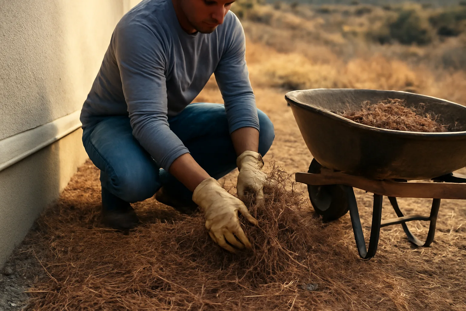
| Zone 0 (ember-resistant) | 0-5 ft | Eliminate ignition points | Remove mulch, combustible plants, stored items; use gravel or pavers | |
|---|---|---|---|---|
| Zone 1 | 5-30 ft | Reduce flame length | Space plants, remove ladder fuels, prune tree limbs 6+ ft up | |
| Zone 2 | 30-100 ft | Slow fire spread | Thin vegetation, mow dry grass, space tree canopies 10+ ft apart | Source: CAL FIRE Defensible Space (PRC 4291) guidance. Outside your own lot, the biggest lever most people actually have is preventing human-caused ignitions, since roughly 85% of wildfires in the U.S. are human-caused according to the National Interagency Fire Center's aggregated wildfire cause statistics cited by the U.S. Forest Service [4]. That means: no debris burning on windy or red-flag days, no dragging trailer chains, no parking hot vehicles over dry grass, and no fireworks in wildland-adjacent areas. |
You can't prevent wildfires from starting in the wilderness, but you can dramatically cut the odds that your specific structure ignites once a fire arrives, and that's the more useful framing. Ember exposure, not direct flame contact, causes the majority of home losses in wildfires, according to CAL FIRE's structure ignition research summarized in its defensible space guidance. The zone-by-zone breakdown: | Zone | Distance from structure | Primary goal | Typical work |
How to prepare for a wildfire (before, during, and after checklist)
Preparing for a wildfire means having your landscape mitigation done before fire season starts, plus a go-bag and evacuation plan ready at all times, because you often get hours, not days, of notice. Ready.gov's wildfire guidance recommends assembling an emergency kit, planning two evacuation routes, and signing up for local emergency alerts before fire season, not during it [5]. Before fire season:
- Finish Zone 0 and Zone 1 clearance (highest-value work per dollar).
- Clean roof and gutters of pine needles and leaf litter.
- Photograph your defensible space work for insurance documentation. This is genuinely useful even outside a claim; dated photos of your cleared zones are the single easiest thing to hand an underwriter who's questioning your renewal.
- Confirm your address is visible from the road for responders. During a fire watch or warning:
- Move patio furniture, doormats, and anything combustible away from the house.
- Close all windows and vents if advised by local fire officials.
- Load your go-bag and evacuate early; don't wait for a mandatory order if conditions look bad. After a fire (whether your home survived or not):
- Document everything with photos and video before cleanup starts.
- Keep receipts for any temporary housing, repairs, or mitigation work. A fair number of homeowners in this situation are dealing with an insurer non-renewal on top of fire risk, more than fire risk itself. If that's you, our $99 Wildfire Insurance Survival Kit is built around exactly that overlap: it helps you organize the defensible space photos, inspection letters, and mitigation records insurers ask for, in the format underwriters actually want to see. We don't file claims or promise reinstatement; the kit just gets your own documentation organized so you can send it yourself. Check it out at /survival-kit-builder.
How to prevent forest fires and avoid forest fires when you're outdoors
Preventing forest fires mostly comes down to controlling ignition sources during dry, windy conditions, since the vast majority of forest fires start from human activity rather than lightning. The National Interagency Fire Center and U.S. Forest Service both cite roughly 85-90% of wildfires nationally as human-caused, covering everything from unattended campfires to equipment sparks and arson [4]. Specific, practical steps when you're in or near forested land: - Check local fire restrictions before building any campfire; many national forests ban campfires entirely during red-flag conditions.
- Never leave a campfire unattended, and drown, stir, and drown again before leaving; a fire that looks out is often still smoldering underneath.
- Avoid parking or idling vehicles over dry grass; catalytic converters routinely exceed 500°F and are a documented ignition source for roadside fires.
- Skip fireworks and exploding targets entirely in wildland areas, even where technically legal, during dry months.
- Maintain chainsaws, mowers, and trimmers; a spark from metal-on-rock contact has started real fires. Smokey Bear's long-running message, "Only you can prevent wildfires," is Forest Service messaging, more than a slogan; it's tied directly to that human-ignition statistic. For more on the campaign and what it actually asks of individuals, see only you can prevent wildfires.
How can we prevent forest fires at a community level
Community-level prevention works through coordinated fuel breaks, shared defensible space standards, and local burn restrictions, because a single unmitigated lot can undermine a whole neighborhood's fire hardening. Firewise USA, a program run by the National Fire Protection Association in partnership with the U.S. Forest Service and state forestry agencies, organizes neighborhoods to do joint chipper days, shared fuel reduction, and coordinated evacuation planning . This matters because fire doesn't respect property lines. If your neighbor has a wood pile against their fence and dry grass to the eaves, your own Zone 0 work does less good than it should, since embers and radiant heat can jump from their structure to yours in a dense subdivision. Practical community steps:
- Petition your HOA or fire district for a joint chipper day or green waste drop-off during peak clearance months.
- Ask your local fire department about community wildfire protection plans (CWPPs), which many California and Oregon counties have adopted under the Healthy Forests Restoration Act framework.
- Coordinate with neighbors on shared fence lines and easements, since defensible space clearing often gets skipped in the ambiguous strip between two properties. For property-specific work once neighborhood coordination is sorted, our defensible guide breaks down the zone math in more detail.
Is Santa Barbara safe from fire
No area in California's chaparral and wildland-urban interface zone, including Santa Barbara, is safe from fire risk, and Santa Barbara County has a well-documented history of major wildfires, including the 2017 Thomas Fire (then the largest in modern California history at the time) and the 2018 Montecito debris flow that followed it. CAL FIRE designates large portions of Santa Barbara County, particularly the foothill and Montecito-adjacent areas, as Very High Fire Hazard Severity Zones on its official FHSZ maps . "Safe" isn't really the right frame for any WUI community in Southern California; "mitigated" is more useful and more achievable. Homes in Santa Barbara's foothill neighborhoods that did their defensible space work, hardened vents, and cleared roof debris had measurably better survival rates in the Thomas Fire compared to unmitigated structures nearby, consistent with CAL FIRE's broader findings on ember-driven home ignition . If you live in or near Santa Barbara, Montecito, Ojai, or similar Central Coast WUI communities, check your parcel's specific hazard zone designation on CAL FIRE's FHSZ viewer rather than relying on general reputation; risk varies block by block depending on slope, aspect, and fuel type.
How to build your own zone-by-zone mitigation plan (worksheet)
Start by measuring your property from the structure outward and marking where each defensible space zone actually falls on your specific lot, since slope and lot size change the math. On slopes over 20%, CAL FIRE's guidance and most local fire codes call for extending clearance distances beyond the flat-ground standard because fire moves faster uphill. Your planning worksheet, zone by zone: Zone 0 (0-5 ft from structure):
- List every combustible item currently in this zone: mulch, planters, firewood stacks, wood fencing attached to the house, doormats.
- Replace with: gravel, pavers, low-growing succulents (with real spacing, not mass planting), or bare mineral soil.
- Local rule fill-in: ___[has your fire district adopted a formal Zone 0 ordinance yet? Y/N and date]___ Zone 1 (5-30 ft):
- List trees and shrubs and their spacing; aim for canopy separation, not a continuous hedge.
- Prune all tree limbs up 6 feet from the ground, or one-third of the tree's height, whichever is less.
- Remove dead or dying vegetation entirely; standing dead fuel burns faster. Zone 2 (30-100 ft):
- Thin trees so canopies are separated by at least 10 feet, per CAL FIRE spacing guidance.
- Mow annual grasses to under 4 inches before they cure and dry.
- Stack firewood at least 30 feet from any structure, not against a fence line that touches the house. Documentation column (do this for every zone):
- Date completed, contractor name if hired, before/after photos, and receipts. That documentation column is the part most homeowners skip and later regret, especially if they're trying to respond to a non-renewal letter or an inspection contingency. For home-hardening items (roof, vents, siding) that pair with this landscape work, see fire safe landscaping California next to house and defensible.
What happens if you don't comply with defensible space rules
Noncompliance can mean a citation, a required corrective action with a deadline, and in repeated or severe cases, a fine from the local fire agency, though enforcement intensity varies enormously by county and fire district. Public Resources Code 4291 also removes certain owner liability protections if defensible space isn't maintained and a fire spreads from an unmaintained property [1]. On the insurance side, the consequence is often faster and more direct: non-renewal. Insurers use aerial and satellite imagery vendors to score properties on vegetation clearance, roof condition, and fuel proximity, and a failing score can trigger non-renewal even without a government citation ever being issued. This is the gap a lot of homeowners fall into: they're in full legal compliance but still lose coverage because the insurer's proprietary scoring model flagged something (a tree limb over the roof, a wood fence touching the structure) that a state inspector wouldn't necessarily cite. If you've already lost coverage or gotten a non-renewal notice tied to wildfire risk, understand that the FAIR Plan in your state is meant as a last-resort option, not a permanent fix, and most FAIR Plans require the same defensible space evidence a standard insurer would want before they'll even quote you. Document your mitigation work regardless of which path you're on.
How much does landscape mitigation actually cost, and is it worth it
Costs vary widely by lot size, slope, vegetation type, and whether you hire licensed contractors or do the work yourself, but homeowners commonly report ranges from a few hundred dollars for DIY Zone 0 work on a small lot to several thousand dollars for professional clearing across a full 100-foot perimeter on a wooded acre. There's no single authoritative national price sheet because labor markets and vegetation density differ so much by region; treat any number you see (including this one) as a rough range, not a quote. What's worth paying for versus doing yourself: - Worth hiring out: large tree limbing (over 15 feet, near power lines), stump removal, and anything requiring a chainsaw on a slope.
- Worth doing yourself: Zone 0 mulch removal and gravel replacement, mowing dry grass, moving firewood stacks, cleaning gutters. The return on this isn't just fire safety, it's insurability. A documented, photographed defensible space effort is often the single piece of evidence that gets a homeowner reconsidered by their carrier or accepted by a new one after a non-renewal. That's the exact overlap our $99 Wildfire Insurance Survival Kit is built for: it's a one-time purchase that helps you organize inspection letters, mitigation photos, and receipts into the documentation format insurers commonly request, so you're not scrambling during a renewal deadline. It doesn't file claims on your behalf, and it's not legal or insurance advice; it just gets your paperwork in order. Start at /survival-kit-builder.
Frequently asked questions
When does the California defensible space law go into effect?
The core 100-foot defensible space law (PRC 4291) has been in effect since 2005. The newer Zone 0 ember-resistant 5-foot rule from AB 3074 (2020) is still moving through Board of Forestry rulemaking, with effective dates repeatedly delayed. Check CAL FIRE's defensible space page for current status before assuming Zone 0 is enforceable in your county.
Why won't people follow the defensible space law in California?
Cost, unclear zone boundaries, and lack of subsidy programs are the main reasons, according to USDA Forest Service research on compliance gaps. Clearing a wooded lot can cost thousands of dollars, and many homeowners are simply unaware of the specific 100-foot standard or which zone rules apply to their slope and lot size.
How do I prevent wildfires from starting on or near my property?
Avoid debris burning on windy or red-flag days, keep vehicles off dry grass, maintain equipment to prevent sparks, and keep defensible space clear so embers landing near your house don't ignite anything. About 85% of U.S. wildfires are human-caused, per National Interagency Fire Center data cited by the U.S. Forest Service.
How do I prepare for a wildfire if I get an evacuation warning?
Move combustible items away from the house, close windows and vents, load a pre-packed go-bag, and leave early rather than waiting for a mandatory order. Ready.gov recommends having two evacuation routes and an emergency kit ready before fire season starts, not during an active warning.
What's the difference between preventing forest fires and defensible space work?
Forest fire prevention is about stopping ignitions in wildland areas (campfires, sparks, equipment). Defensible space is about keeping your specific structure from igniting once a fire is already burning nearby. You need both: responsible outdoor behavior plus a cleared, hardened property.
What fire-safe home rules take effect in 2026?
The clearest 2026-adjacent item is California's phased Zone 0 ember-resistant zone regulation rollout, though exact dates have shifted multiple times and should be confirmed on CAL FIRE's current regulatory page. Some insurers and local jurisdictions have also set their own 2025-2026 compliance deadlines independent of state law.
Is Santa Barbara safe from fire?
No community in California's wildland-urban interface is fully safe from fire, and Santa Barbara County has significant Very High Fire Hazard Severity Zone areas per CAL FIRE mapping. The 2017 Thomas Fire and 2018 Montecito debris flow show the real risk. Mitigated homes fare far better than unmitigated ones nearby.
How can we prevent forest fires as a neighborhood or community?
Coordinate defensible space across property lines, since fire doesn't stop at a fence. Firewise USA (run by the National Fire Protection Association) organizes neighborhood chipper days and shared fuel reduction. Ask your fire district about a Community Wildfire Protection Plan for your area.
What are the three defensible space zones and their distances?
Zone 0 is 0-5 feet from the structure (ember-resistant, noncombustible materials). Zone 1 is 5-30 feet (spaced, pruned, low-fuel plants). Zone 2 is 30-100 feet (thinned trees, mowed dry grass). CAL FIRE's PRC 4291 guidance defines all three.
Does defensible space actually stop insurance non-renewal?
It's not guaranteed, but documented defensible space work is one of the strongest pieces of evidence homeowners have when responding to a non-renewal or seeking new coverage. Insurers score vegetation clearance via aerial imagery, so photographed, dated mitigation work directly addresses what triggered many non-renewals.
How much does full defensible space landscaping cost?
Costs range widely: a few hundred dollars for DIY Zone 0 work on a small lot, up to several thousand dollars for professional clearing across a full 100-foot perimeter on a wooded acre. There's no single authoritative national price study, so treat any figure, including this range, as approximate.
What should I do first if I got a wildfire risk inspection letter?
Read exactly what triggered the flag (usually vegetation touching the structure, overhanging limbs, or roof debris), fix the highest-risk items first (Zone 0), and photograph everything with dates. Then check your local fire district's current defensible space ordinance before assuming state minimums apply.
Sources
- California Legislature, Public Resources Code Section 4291: Statutory basis for the 100-foot defensible space requirement and liability provisions
- Arizona Department of Forestry and Fire Management, Firewise Program: Arizona relies on local and Firewise guidance rather than a statewide defensible space law
- National Interagency Fire Center, Wildfire Causes and Statistics: Roughly 85-90% of U.S. wildfires are human-caused
- National Fire Protection Association, Firewise USA: Community-level defensible space coordination through neighborhood recognition program
- CAL FIRE, Fire Hazard Severity Zone Maps: Santa Barbara County foothill and Montecito-adjacent areas designated Very High Fire Hazard Severity Zones