Last updated 2026-07-23
TL;DR
No place in San Diego County is fully safe from fire, but risk varies a lot by neighborhood. Coastal, dense urban areas (downtown, Point Loma, Pacific Beach) face low direct wildfire risk. Foothill and backcountry communities (Ramona, Alpine, Julian, Poway edges) sit in CAL FIRE-designated Very High Fire Hazard Severity Zones and have burned repeatedly since 2003.
Is San Diego safe from the fires right now?
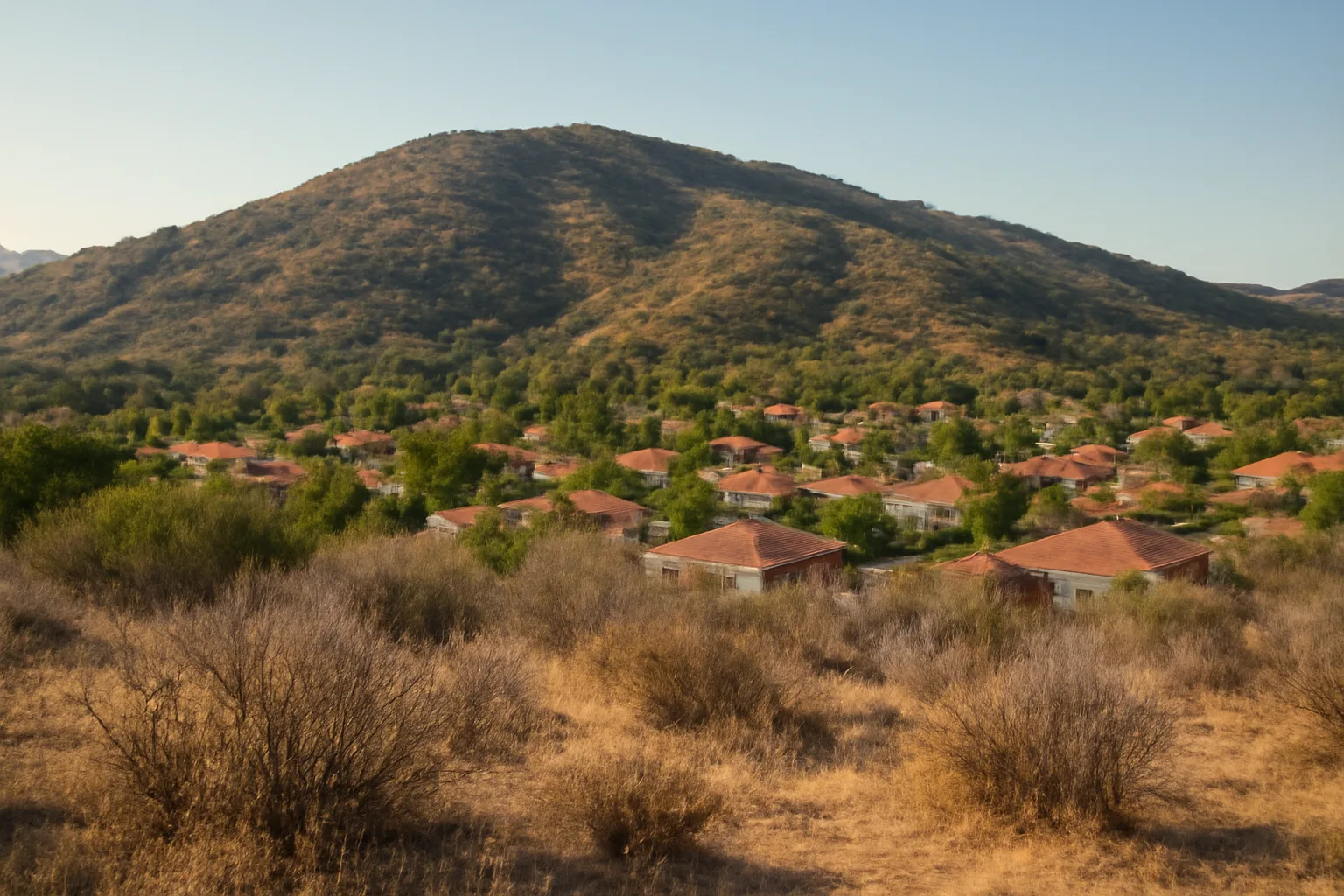
Partly, and it depends entirely on which San Diego you mean. The city core, the beach communities, and most of the urbanized coastal strip carry low direct wildfire exposure because there's little wildland fuel next to homes. But "San Diego" in the insurance and fire-risk sense usually means San Diego County, and a huge chunk of that county is not safe in any meaningful sense. CAL FIRE's Fire Hazard Severity Zone maps classify large swaths of the county's inland and foothill areas, Ramona, Alpine, Descanso, Julian, Jamul, parts of Poway and Valley Center, as Very High Fire Hazard Severity Zones (VHFHSZ) [1]. This isn't theoretical. San Diego County has had three of the largest and most destructive fire events in modern California history: the 2003 Cedar Fire (273,246 acres, 2,232 structures destroyed, 15 deaths), the 2007 Witch Fire and its companion fires (over 197,000 acres combined, 1,650-plus structures lost), and the 2014 San Diego County firestorm (nine separate fires in one week during a May heat wave). If you live in La Jolla or downtown, your risk profile looks nothing like someone in Harbison Canyon or Wynola. So the honest answer: safe-ish if you're in the dense coastal core, genuinely at risk if you're anywhere near the chaparral-covered foothills, canyons, or backcountry. Insurance companies have figured this out too, which is why non-renewals have concentrated hard in the VHFHSZ zip codes over the last five years.
Which San Diego neighborhoods actually have wildfire risk?
| Dense urban coastal | Downtown, Point Loma, Pacific Beach, Mission Beach | Non-VHFHSZ / low | |
|---|---|---|---|
| Canyon-adjacent suburban | Tierrasanta, Scripps Ranch, Rancho Bernardo, Del Cerro | Moderate to High (parcel-dependent) | |
| Foothill/wildland-urban interface | Poway edges, Alpine, Jamul, Valley Center | High to Very High | |
| Rural backcountry | Ramona, Julian, Descanso, Pine Valley | Very High | You can check your exact parcel on CAL FIRE's Fire Hazard Severity Zone viewer rather than guessing from a neighborhood name, because the zone lines often cut through the middle of a community [1]. If your street backs onto open space, a canyon, or unmaintained brush, treat yourself as high-risk regardless of what the general area is known for. For context on how this compares to another coastal fire-prone city that gets asked about constantly: is Santa Barbara safe from fire? Similar answer, different geography. Santa Barbara's urban core along the coast is comparatively insulated, but the foothill communities pressed against the Santa Ynez range (Montecito, upper Mission Canyon, the areas burned in the 2017 Thomas Fire and hit by the 2018 Montecito debris flow that killed 23 people) carry some of the highest wildfire-to-debris-flow compound risk in the state. |
Risk in San Diego County breaks roughly into three bands: urban core (low), transitional canyon/interface (moderate to high), and inland/backcountry (very high). Canyon-adjacent neighborhoods inside the city itself, like parts of Tierrasanta, Rancho Bernardo, Scripps Ranch, and Del Cerro, sit closer to moderate risk than people expect because they back up to steep, brush-filled canyons that carried fire in 2003 and 2007. Here's a rough breakdown homeowners use to sanity-check their own address: | Area type | Example communities | Typical CAL FIRE hazard tier |
When does the California defensible space law go into effect?
California's core defensible space requirement, 100 feet of vegetation management around structures in State Responsibility Areas and some VHFHSZ local jurisdictions, has been law since 2005 under Public Resources Code 4291, and it's actively enforced today, not some future rule. What's changing is the more detailed "zone" structure and the new ember-resistant zone immediately next to the house. Assembly Bill 3074 (2020) directed the State Fire Marshal to write regulations for a new "Zone 0," the ember-resistant zone within 5 feet of a structure, with stricter limits on combustible materials, mulch, and plants directly against the house. As of the most recent guidance, the Office of the State Fire Marshal has been working through rulemaking on Zone 0, and the effective date has been pushed back multiple times; homeowners in high-risk zones should check the current status directly on the State Fire Marshal's defensible space page rather than relying on a fixed date, because it has moved before. Separately, people ask what fire-safe rules for homes take effect in 2026. There isn't one single national "2026 rule." What's actually happening is a patchwork: California's Zone 0 ember-resistant zone regulations are in an extended rulemaking process, some insurers are adopting their own 2025-2026 underwriting standards tied to Wildfire Prepared Home certification from IBHS, and several county fire districts are updating local defensible space ordinances on their own timelines. Don't wait for a single deadline. Check your specific fire district's current ordinance and your state fire marshal's page, because "defensible space law" language varies by whether you're in a State Responsibility Area, Local Responsibility Area, or a Very High Fire Hazard Severity Zone inside city limits. Mitigation rules vary by fire district: [insert your local fire district name and ordinance number here] typically layers additional requirements on top of the state minimum, so pull your district's current defensible space bulletin before doing any clearing work.
Why won't people follow the defensible space law in California?
Cost, confusion, and enforcement gaps are the three real reasons, not laziness. Clearing 100 feet of defensible space on a sloped, brush-covered half-acre lot can run into thousands of dollars in contractor labor, and many homeowners, especially retirees on fixed incomes in places like Julian or Descanso, simply can't absorb that cost every year. There's also a real information gap. A lot of homeowners genuinely don't know which zone their property falls in, don't know the 100-foot rule applies to them specifically, or assume a one-time clearing years ago still counts. Defensible space isn't a permanent home improvement, it's landscaping maintenance that has to happen annually before fire season, and that recurring cost and effort is where compliance falls apart for a lot of people. Enforcement is uneven too. CAL FIRE and local fire departments do inspections, but with limited staff covering huge rural areas, a lot of properties simply never get inspected in a given year. Some counties have gotten more aggressive: violations under PRC 4291 can result in citations and, in repeat cases, the fire agency can do the clearing itself and bill the property owner. But the threat of enforcement isn't uniform across San Diego County's dozens of fire districts, so compliance rates vary a lot by jurisdiction. If you want a structured way to actually get through defensible space work without guessing at zones, see our defensible space zone breakdown walks through what Zone 1 and Zone 2 actually require in plain language.
How to prevent wildfires around your own home
You can't stop a wildfire from starting in the backcountry, but you have real control over whether your house is the thing that catches. The two biggest controllable factors are ember-resistant construction details and clearing flammable material within 5 feet of the structure, because most homes lost in wildfires ignite from wind-blown embers landing on or near the house, not from a wall of flame arriving. Practical priorities, in rough order of impact per dollar spent: clear anything combustible (mulch, dry leaves, stored firewood, patio furniture cushions) within 5 feet of exterior walls; install 1/8-inch metal mesh over vents to stop ember intrusion; clean gutters and roof valleys of pine needles and leaves before fire season; replace any wood fencing that attaches directly to the house with a metal or non-combustible section for the first several feet. Beyond your own lot, community-level prevention matters more than most homeowners realize. Roughly 85% of wildfires nationally are human-caused, according to National Interagency Fire Center data cited by federal agencies, meaning things like unattended campfires, dragging trailer chains, and equipment sparks account for the large majority of ignitions. That's the practical answer to "how can we prevent forest fires": most of it comes down to preventing the ignition in the first place, not fighting the fire after it starts. For a home-hardening checklist you can actually work through room by room, our home fire prevention guide breaks down the highest-leverage retrofits by cost.
How to prepare for a wildfire before it happens
Preparation has to happen months before fire season, not during a red flag warning. Ready.gov's wildfire preparedness guidance breaks this into three buckets: defensible space around the home, an evacuation plan with multiple routes, and a go-bag with essential documents ready year-round. Here's a realistic prep timeline for a California homeowner: - Spring (before fire season): clear defensible space zones, trim tree limbs 10 feet from chimneys and roofs, service any onsite water pumps or tanks.
- Early summer: photograph every room and major exterior feature of your home for insurance documentation, update your home inventory, confirm your evacuation routes with family.
- Peak fire season (varies by region, often June through November in Southern California): keep a full tank of gas, keep N95 masks and a battery radio accessible, know your local fire district's evacuation zone number.
- Anytime a Red Flag Warning is issued: load your vehicle with your go-bag and documents, park facing the street, and know your two fastest routes out. Ready.gov specifically recommends creating a household disaster plan that includes "a communication plan and meeting locations" separate from the evacuation route itself, since cell networks often get overloaded during major fire events. On documentation specifically: this is where a lot of homeowners get caught flat-footed after a fire, or after an insurer sends a non-renewal letter demanding proof of mitigation work. Photographing your defensible space clearing, keeping contractor receipts, and dating your inspection reports matters just as much as the physical work itself, because insurers increasingly want to see proof, more than a claim that you did it. This is the exact gap the $99 Wildfire Insurance Survival Kit is built to close: a structured way to document your defensible space work, home hardening upgrades, and inspection history so you have an insurer-ready packet instead of a folder of scattered photos. It's not a claims or negotiation service, it's a documentation tool you build yourself. Check the survival-kit-builder if you want a starting template.
How to prevent forest fires and avoid forest fires as a homeowner
"Preventing forest fires" and "protecting your home from forest fires" are two different problems, and homeowners often conflate them. You can't prevent a forest fire from igniting miles away in wildland terrain. What you can do is reduce the odds that an approaching fire destroys your specific structure, and reduce your own household's odds of accidentally starting one. On the ignition-prevention side: never park a hot vehicle on dry grass (catalytic converters routinely start roadside fires), extinguish campfires completely and check for warm embers with your hand before leaving, avoid mowing dry grass during the heat of the day, and maintain equipment (chainsaws, mowers, generators) to avoid sparking. The U.S. Forest Service and CAL FIRE both point to debris burning, equipment use, and campfires as leading human-caused ignition categories, alongside power line failures during high wind events [1]. On the home-protection side, the work is the same defensible space and hardening work covered above. If you're trying to figure out how to avoid forest fires reaching your specific property, the honest framing is: you can't avoid the fire, you can only avoid giving it fuel and ember pathways once it arrives. That's the entire logic behind CAL FIRE's zone system, and it's why insurance companies increasingly ask for proof of that work rather than proof of "fire prevention" in the abstract. For landscaping choices that reduce fuel load without turning your yard into gravel, our fire-safe landscaping guide covers which plants to keep, which to remove, and spacing rules for the zone closest to the house.
What does defensible space actually require, zone by zone?
| Zone 0 | 0-5 ft | Ember-resistant, minimal combustibles (regulations still finalizing) | |
|---|---|---|---|
| Zone 1 | 5-30 ft | Remove dead plants, space live vegetation, clear roof/gutter debris | |
| Zone 2 | 30-100 ft | Reduce fuel continuity, maintain irrigated or low-fuel landscaping | Mitigation rules vary by fire district: [insert local fire district name] may require additional clearance beyond 100 feet on steep slopes, or different rules for cul-de-sac or shared-easement lots, so confirm with your specific district before finalizing a landscaping plan. If you're documenting this work for an insurer, the zone-by-zone structure is also exactly how most insurance wildfire mitigation surveys are organized, so keeping your own records in the same format saves a lot of back-and-forth. |
California's defensible space rule under PRC 4291 breaks the 100 feet around a home into zones with different rules, and most homeowners have never actually read the specifics. Zone 0 (0 to 5 feet from the structure) is the newest and strictest, aiming for near-total removal of combustible material right against the house. Zone 1 (5 to 30 feet) requires removing dead vegetation, spacing out shrubs and trees, and keeping grass low. Zone 2 (30 to 100 feet) allows more natural landscaping but still requires reduced fuel continuity, meaning no unbroken line of dry brush that lets fire run straight at the house [1]. | Zone | Distance from structure | Core requirement |
How San Diego's fire risk compares to other California fire zones
San Diego County's risk profile is driven heavily by Santa Ana wind events, which push hot, dry offshore winds through canyons at speeds that can exceed 40-60 mph during red flag conditions, the same wind pattern implicated in the 2003 Cedar Fire, 2007 Witch Fire, and Los Angeles County's devastating January 2025 Palisades and Eaton Fires. That wind-driven pattern makes San Diego and Los Angeles County somewhat comparable, both are chaparral-covered, Santa Ana-exposed regions where fires can move extremely fast, sometimes advancing a mile or more per hour under peak wind conditions. Santa Barbara County shares the Santa Ana-adjacent wind exposure but adds a second hazard layer: steep, burned watershed slopes that produce debris flows after fire, which is what turned the 2017 Thomas Fire burn scar into the deadly January 2018 Montecito debris flow. So "is Santa Barbara safe from fire" carries an extra asterisk that San Diego mostly doesn't: post-fire flood and mudslide risk in the foothill communities. Compared to Northern California's more forest-and-timber fire regime (the kind that produced the 2018 Camp Fire, which killed 85 people and destroyed the town of Paradise), San Diego and Southern California generally burn faster but in shorter, more explosive wind-driven events rather than slow-moving, weeks-long forest fires. Different fire behavior means different hardening priorities: wind-driven ember storms reward Zone 0 hardening heavily, while slower forest fires give more time for defensible space clearing to actually stop flame contact.
How insurance non-renewals connect to all of this
If you've gotten a non-renewal letter, it's almost never random. Insurers pulling out of California wildfire zones cite the state's own CAL FIRE hazard maps and increasingly use third-party wildfire risk scoring models (like those from Verisk or CoreLogic) that weight VHFHSZ designation, slope, vegetation density, and distance to fire station heavily [1]. The California Department of Insurance's Sustainable Insurance Strategy, rolled out starting in 2024, is specifically trying to get insurers back into high-risk areas in exchange for allowing them to use forward-looking catastrophe models in rate-setting, but that's a slow regulatory process, not an immediate fix for a homeowner holding a non-renewal notice right now. What you can control today: documenting your defensible space compliance, your home hardening upgrades (Class A roofing, ember-resistant vents, dual-pane windows), and any inspection reports from your local fire district. When you appeal a non-renewal or shop for FAIR Plan or surplus lines coverage, that documentation is the entire case you're making. Insurers and agents want proof, not assurances. To be clear about what this article and this brand do and don't do: we don't negotiate with insurers, file claims on your behalf, or promise coverage, discounts, or reinstatement. What we help you do is build the documentation packet, photos, receipts, inspection dates, mitigation records, that you send yourself to your insurer or agent. That's the entire function of the $99 Wildfire Insurance Survival Kit, and you can start one at the survival-kit-builder whenever you're ready. For a wider look at how other homeowners have navigated non-renewal and re-coverage, our comparison of state wildfire mitigation programs is useful if you're weighing whether to stay in California or you own property across state lines.
Frequently asked questions
Is San Diego safe from wildfires?
Coastal and dense urban San Diego (downtown, Point Loma, Pacific Beach) faces low direct wildfire risk. Inland and foothill areas (Ramona, Alpine, Julian, parts of Poway) sit in CAL FIRE Very High Fire Hazard Severity Zones and have burned repeatedly since 2003, including the 273,246-acre Cedar Fire [1][2]. Check your exact parcel on CAL FIRE's hazard viewer rather than guessing.
When does the California defensible space law go into effect?
The core 100-foot defensible space requirement under Public Resources Code 4291 has been law since 2005 and is enforced now. The newer Zone 0 ember-resistant zone rule (within 5 feet of structures), created by AB 3074, is still in State Fire Marshal rulemaking and its effective date has been delayed more than once; check the State Fire Marshal's site for current status [4][5].
Why won't people follow the defensible space law in California?
Mostly cost and confusion, not defiance. Annual clearing on sloped, brush-heavy lots can cost thousands of dollars, many homeowners don't know which hazard zone applies to their parcel, and enforcement is inconsistent across California's many fire districts, so a lot of non-compliant properties simply never get inspected in a given year.
How do I prevent wildfires from starting near my home?
Most wildfires are human-caused. Never park a hot vehicle on dry grass, fully extinguish campfires and check for warm embers by hand, avoid mowing dry grass in peak heat, and keep equipment like chainsaws and generators properly maintained to avoid sparks. NIFC data cited by federal agencies puts roughly 85% of wildfires as human-caused [7].
How do I prepare for a wildfire if I live in a high-risk zone?
Clear defensible space before fire season, photograph your home and belongings for insurance records, plan two evacuation routes, and pack a go-bag with documents, medications, and a battery radio. Ready.gov recommends a household communication plan since cell networks often overload during major fire events [8].
How can we prevent forest fires as a community, more than individually?
Community-level prevention focuses on reducing ignition sources: enforcing campfire and debris-burning restrictions during dry periods, maintaining power line clearance, and supporting local fire district inspections. Individually, avoiding equipment sparks and properly extinguishing any open flame source covers most preventable ignition causes.
What fire-safe rules for homes take effect in 2026?
There's no single 2026 national rule. California's Zone 0 ember-resistant zone regulations remain in extended State Fire Marshal rulemaking, some insurers are adopting 2025-2026 underwriting standards tied to IBHS Wildfire Prepared Home certification, and individual fire districts are updating local ordinances on their own schedules. Check your specific district and the state fire marshal's page directly.
Is Santa Barbara safe from fire?
Similar pattern to San Diego: the coastal core has lower direct wildfire risk, but foothill communities like Montecito and upper Mission Canyon carry high risk plus an added post-fire debris flow hazard, as shown by the January 2018 Montecito debris flow that killed 23 people after the 2017 Thomas Fire burn scar failed [3].
What's the difference between Zone 0, Zone 1, and Zone 2 defensible space?
Zone 0 (0-5 feet from the structure) requires near-total removal of combustibles and is still being finalized in regulation. Zone 1 (5-30 feet) requires removing dead vegetation and spacing shrubs and trees. Zone 2 (30-100 feet) allows more natural landscaping but requires reduced fuel continuity so fire can't run unbroken toward the house [1][4].
Does clearing defensible space guarantee my insurance won't get non-renewed?
No. Defensible space work reduces your actual fire risk and gives you documentation to support an appeal or a new policy application, but no mitigation work guarantees renewal or a discount. Insurers set their own underwriting criteria, and this article isn't insurance or claims advice.
How fast can a Santa Ana wind-driven fire move in San Diego County?
Under peak red flag conditions with sustained winds of 40-60 mph, wind-driven chaparral fires in Southern California have been documented advancing roughly a mile or more per hour, which is the same wind pattern behind the 2003 Cedar Fire, 2007 Witch Fire, and the January 2025 Los Angeles County fires [2][9].
What should I photograph for insurance before a wildfire threatens my area?
Photograph every room, built-in appliances, the exterior on all four sides, your roof material, vents, and any defensible space clearing work with visible dates. Keep contractor receipts and inspection reports together. This documentation matters most after a non-renewal letter or a claim, when insurers ask for proof rather than a verbal description.
Do all San Diego County fire districts have the same defensible space rules?
No. State law sets the 100-foot minimum under PRC 4291, but individual fire districts can add stricter local requirements, especially on steep slopes or in specific community wildfire protection plan areas. Confirm your local district's current ordinance rather than assuming the state minimum is all that applies.
Sources
- CAL FIRE, Fire Hazard Severity Zones: San Diego County's foothill and backcountry areas are designated Very High Fire Hazard Severity Zones
- CAL FIRE: California's defensible space law requires 100 feet of defensible space around homes in wildfire-prone areas
- CAL FIRE Ready for Wildfire: Defensible space is divided into zones with different requirements, zone by zone
- California Department of Insurance: Insurance non-renewals in wildfire-prone areas of California are connected to fire risk assessments
- California Legislative Information: California Public Resources Code Section 4291 establishes defensible space legal requirements
- CAL FIRE: Fire Hazard Severity Zone maps identify which San Diego neighborhoods have elevated wildfire risk
- CAL FIRE Ready for Wildfire: Defensible space requirements differ by zone distance from the home, zone by zone
- California Department of Insurance: Homeowners can use a Safer from Wildfires mitigation form to potentially reduce insurance non-renewal risk