Last updated 2026-07-25
TL;DR
Drones help wildfire mitigation mainly through mapping, thermal detection, and post-inspection documentation, not through cutting brush or hauling debris. Fire agencies use them for aerial ignition (prescribed burns) and early detection; homeowners mostly benefit from drone-based defensible space surveys and photo documentation for insurers. They cost roughly $150 to $800 for a residential survey and don't replace hand clearing, chipping, or the physical Zone 0 work CAL FIRE's 2026 ember-resistant rule will require.
What do drones actually do for wildfire mitigation?
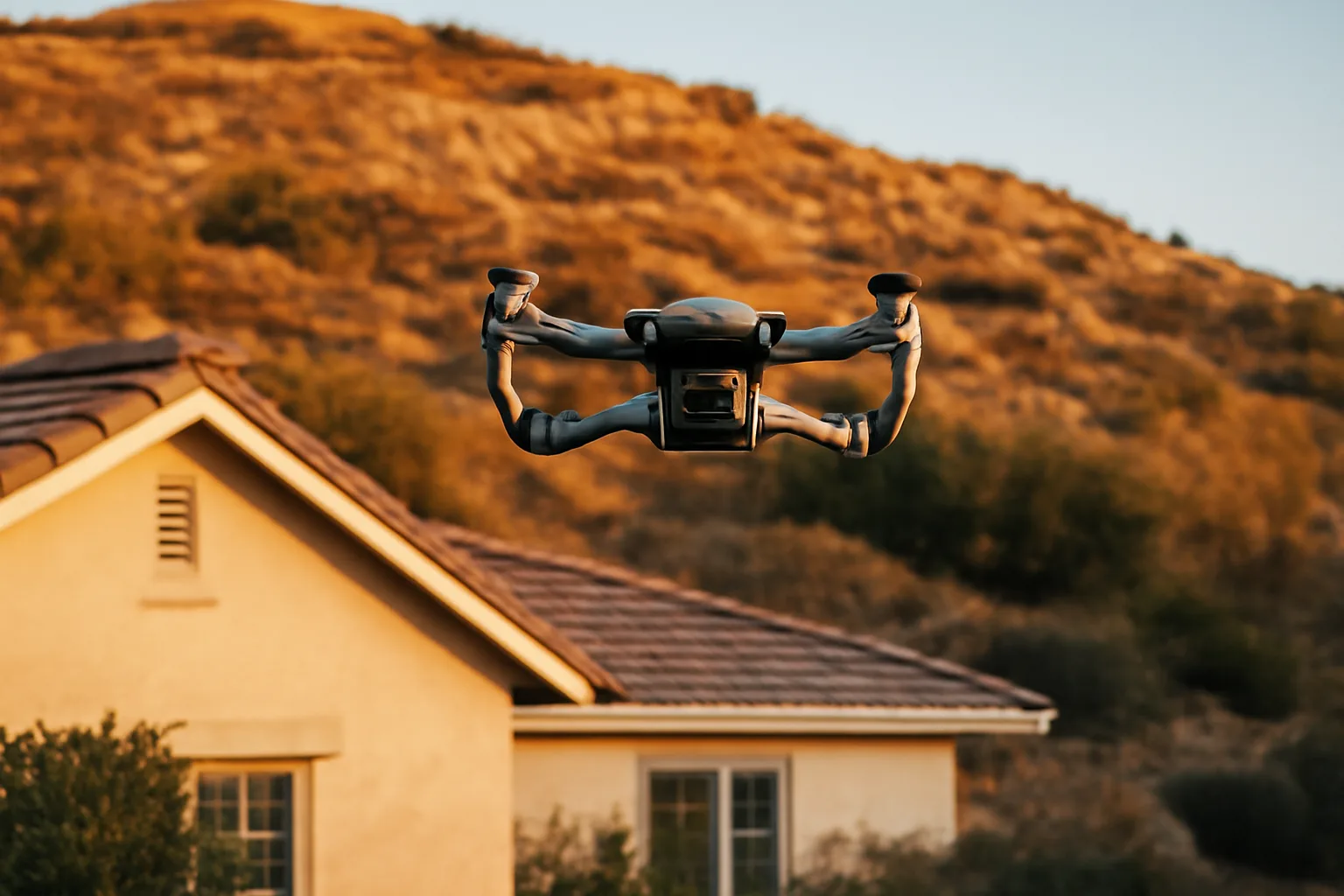
Drones do three jobs well in wildfire work: they map vegetation and fuel loads from the air, they carry thermal cameras that spot heat signatures through smoke, and they help drop incendiary spheres to set controlled burns ahead of a fire front. What they don't do is cut brush, remove dead trees, or haul slash to a chipper. If you're picturing a robot that clears your defensible space while you sleep, that product doesn't exist yet at any price a homeowner would pay. CAL FIRE and other agencies use fixed-wing and multirotor drones for aerial reconnaissance during active incidents, feeding real-time video to incident commanders so they can route crews and engines without waiting on a piloted aircraft [1]. Some fire departments use drone-mounted "dragon egg" launchers that fire small ping-pong-ball-sized spheres filled with potassium permanganate, igniting backfires and burnout operations from a safe standing distance instead of sending a hand crew with drip torches into steep terrain. For homeowners, the realistic use case is smaller: a drone with a good camera flies your property, photographs your roof, gutters, vents, and the ground within 5 feet of your house (what CAL FIRE calls Zone 0), and gives you and, eventually, an insurer, a clear aerial record of what your defensible space actually looks like. That's documentation, not mitigation. The mitigation still happens with loppers, a chainsaw, and a rake. If you want the ground-level version of that same work, read up on defensible space clearing contracts before you hire anyone, drone-equipped or not.
Can a drone survey replace a defensible space inspection?
No, not for compliance purposes. A drone survey is a useful supplement to an inspection, not a substitute for one, because most fire districts still require a human inspector to sign off on defensible space compliance, and insurers doing wildfire risk scoring typically send their own inspector or use satellite/aerial imagery from a vendor they've already contracted. What a drone survey is genuinely good for: catching problems you can't see from the ground. Roof valleys clogged with pine needles, a chimney cap that's rusted through, a section of gutter guard that's failed, dead branches hanging over the roofline from a tree you can't safely climb. A 10-minute drone flight around your house, recorded and time-stamped, gives you a before-and-after record that's genuinely useful if your insurer later disputes what condition your property was in. Cost for a residential drone survey from a local operator typically runs $150 to $800 depending on lot size and whether you want a written report with annotated photos or just raw footage. That's cheap insurance against a coverage dispute, but it is a nice-to-have, not a replacement for your county or fire district's actual defensible space inspection, which is usually free and the one that carries legal weight. See our guided inspections breakdown for what inspectors are actually checking, zone by zone.
When does the California defensible space law go into effect?
California's core defensible space law, Public Resources Code 4291, has been in effect since long before 2026; it currently requires 100 feet of defensible space clearance around structures in State Responsibility Areas and designated wildland-urban interface zones, split into an ember-resistant Zone 0 (0-5 feet) and a reduced-fuel Zone 2 (30-100 feet) [2]. What's changing in 2026 is the Zone 0 ember-resistant standard, which CAL FIRE's Board of Forestry has been developing under regulations that were expected to take effect for new construction first and existing homes on a phased timeline. The short version: the 100-foot clearance requirement isn't new. The specific, prescriptive Zone 0 rules (no combustible mulch, no wood fencing attached to the house within 5 feet, no combustible items stored against the structure) are the part getting formalized, and CAL FIRE has stated Zone 0 requirements would first apply to new construction, with existing home compliance timelines to follow. Check your specific fire district's page for the exact date it takes effect locally, because implementation timing has shifted more than once and enforcement is handled at the local level, not uniformly by the state. [Fill in: your fire district's specific Zone 0 enforcement start date here, since this varies by county and CAL FIRE unit.] For the landscaping side of Zone 0 compliance, our guide to fire-safe landscaping next to the house walks through what's allowed in that first 5 feet and what isn't.
What fire-safe home rules take effect in 2026?
The most consequential 2026-adjacent rule is CAL FIRE's Zone 0 ember-resistant zone standard, developed under the authority of Assembly Bill 3074 (2020), which directed the Board of Forestry and Fire Protection to adopt regulations for the 0-to-5-foot zone immediately surrounding structures [3]. The regulation targets the space where wind-blown embers land and ignite homes, which CAL FIRE and post-fire investigations consistently identify as the dominant way homes ignite during wildfires, not direct flame contact. Separately, California's insurance side is shifting too. The California Department of Insurance's Sustainable Insurance Strategy, implemented through regulations effective 2025 into 2026, allows insurers to use catastrophe modeling in rate-setting in exchange for writing more policies in high-risk wildfire areas, and ties expanded FAIR Plan access to insurers demonstrating they're writing standard policies in wildfire-prone ZIP codes [4]. That's not a home-hardening rule, but it directly affects whether non-renewed homeowners can get back into a standard market policy, so it's worth tracking alongside the physical mitigation rules. On the building code side, the 2025 California Building Code (Title 24) cycle, which takes effect January 1, 2026 for most jurisdictions, continues to reference Chapter 7A wildland-urban interface construction standards for new builds and major remodels in Fire Hazard Severity Zones, covering ignition-resistant roofing, vents, siding, and decking [5]. [Fill in: confirm your county's exact 2026 code adoption date, since local jurisdictions can adopt on a delayed schedule.]
Why won't people follow the defensible space law in California?
Cost, labor shortage, and enforcement gaps are the three real reasons, not ignorance of the rule. Clearing 100 feet of defensible space on a sloped, oak-covered lot can run $3,000 to $15,000 depending on vegetation density and whether you need a licensed contractor for tree removal, and many homeowners, especially retirees on fixed incomes in fire-prone foothill communities, simply can't front that cost every year. CAL FIRE's own inspection data has repeatedly shown compliance rates well below 100% in audited areas; a 2019 CAL FIRE report to the legislature found many properties inspected were not in full compliance with PRC 4291, and enforcement historically relied on local fire agencies issuing notices to comply rather than citations, with follow-up inspections often understaffed [6]. Vegetation also grows back. A property compliant in April can be out of compliance by August, and most homeowners aren't clearing brush twice a year. There's also a genuine information gap about what actually counts. Homeowners often think removing all vegetation is required; the law actually calls for "defensible space" through reduced fuel continuity, spacing, and lower flammability plants, not bare dirt. Confusion over specifics leads some people to do nothing rather than do it wrong. Finally, enforcement varies enormously by fire district. Some counties send inspectors annually and follow up with citations; others rely almost entirely on self-certification or complaint-driven inspections, so the practical consequence of non-compliance ranges from a fine to genuinely nothing, depending on where you live.
How do I prepare for a wildfire, step by step?
Preparing for a wildfire has three tracks that all matter: defensible space around the home, hardening the structure itself, and a household evacuation plan you've actually rehearsed. Skipping any one of the three leaves a real gap, because a hardened house with no clearance still burns from ground fuels, and a cleared yard with a vented, wood-sided house still loses to embers. Start with Zone 0 (0-5 feet from the house): remove all combustible mulch, dead plants, and anything wood-based touching the structure. Move firewood stacks, propane tanks, and wood fences away from direct contact with the house. Then work outward through Zone 1 (5-30 feet) and Zone 2 (30-100 feet), thinning vegetation, removing ladder fuels (low branches that let ground fire climb into tree canopies), and keeping grass mowed to under 4 inches [2]. On the structure itself: clear gutters and roof valleys of debris, install 1/8-inch metal mesh over attic and foundation vents to block embers, and consider Class A fire-rated roofing if you're due for a replacement anyway. Ready.gov recommends creating a family communication plan and a go-bag with medications, documents, and supplies for at least 72 hours, kept somewhere you can grab it in under two minutes. Document everything as you go. Insurers increasingly ask for proof of mitigation work, dated photos, receipts, contractor invoices, when you're contesting a non-renewal or applying for reinstatement. This is where a $99 Wildfire Insurance Survival Kit is genuinely useful: it gives you a structured way to organize that documentation (photos by zone, contractor receipts, inspection reports) so you're not scrambling to reconstruct a year of mitigation work from memory when a letter shows up. We don't file claims or handle insurer communications for you; you send your own documentation, we just help you build the packet. For what an actual house fire does to an unhardened structure versus a hardened one, our house fire piece has real comparison detail.
How can homeowners and communities help prevent wildfires?
Individual mitigation work only goes so far; wildfire prevention is genuinely a neighborhood problem because embers travel up to a mile ahead of a fire front and one uncleared lot can re-ignite a whole cleared block. The single highest-leverage action a homeowner can take, according to fire investigators, is Zone 0 ember-resistant hardening, because most home ignitions during wildfires come from ember showers landing on or against the structure, not direct flame contact. At the community level, that means pushing for coordinated defensible space compliance among neighbors, more than your own lot. CAL FIRE's Fire Safe Council network and local Firewise USA-recognized communities coordinate group brush clearing, chipper days, and shared cost programs that make compliance cheaper for everyone [7]. If your neighborhood doesn't have one, starting the conversation with your HOA or a few neighbors is often more effective than individual compliance in isolation. Other prevention basics matter more than people expect: never park a hot vehicle on dry grass (catalytic converters routinely start fires), follow local burn-ban restrictions during red flag warnings, and report unattended campfires or downed power lines immediately rather than assuming someone else will. Human activity, including equipment use, debris burning, and vehicles, causes the vast majority of wildfires nationally, not lightning, so behavior change is a real prevention lever, more than infrastructure [8]. See only you can prevent wildfires for more on the human-caused ignition side of this.
How do you prevent forest fires versus fires at your home?
Forest fire prevention and home wildfire mitigation overlap but aren't identical problems, and conflating them is a common mistake. Forest fire prevention is mostly about ignition source control (extinguishing campfires fully, maintaining equipment to avoid sparks, following burn permits) and landscape-scale fuel management (prescribed burns, mechanical thinning) run largely by the U.S. Forest Service and state agencies, not individual homeowners. Home wildfire mitigation is about surviving a forest fire that's already burning nearby, which is a defensible space and structure-hardening problem, not an ignition-prevention problem. You can't stop a forest fire fifteen miles away from starting, but you can dramatically change whether your specific house survives when it arrives. The National Institute of Standards and Technology's research on the 2018 Camp Fire and other WUI disasters found that home ignition is overwhelmingly driven by embers and short-range radiant heat from burning vegetation and structures near the home, not by direct contact with the main fire front, which is why defensible space and ember-resistant construction have more effect on individual home survival than anything happening in the forest itself. So when someone asks "how do I prevent forest fires," the honest answer split is: reduce ignition risk (fire-safe camping and equipment behavior) if you're asking about wildland fires generally, but if you're asking because you're worried about your own house, the answer is defensible space and hardening, full stop.
Is Santa Barbara safe from fire?
No area of Santa Barbara County is fully safe from wildfire risk; the county has a documented history of major fires, including the 2017 Thomas Fire (which burned over 280,000 acres and was, at the time, the largest wildfire in modern California history) and the debris flow that followed in Montecito in January 2018, killing 23 people . Much of the county's foothill and canyon communities sit directly in a state-mapped Fire Hazard Severity Zone. That said, risk varies enormously within the county. Coastal, flatter areas of the city of Santa Barbara itself carry meaningfully lower wildfire exposure than foothill communities like Montecito, Mission Canyon, or the San Roque area, which sit closer to chaparral-covered hillsides. CAL FIRE's Fire Hazard Severity Zone maps, viewable on the state's official mapping tool, break this down parcel by parcel, and it's worth checking your specific address rather than assuming risk based on the city name alone . Insurance non-renewals in Santa Barbara County have followed this same pattern: foothill and WUI-adjacent properties are seeing far higher non-renewal rates than flatter coastal parcels, consistent with statewide data showing insurers pulling back fastest in designated high and very-high severity zones. If you got a non-renewal letter from a Santa Barbara-area property, check whether your parcel sits in a Very High Fire Hazard Severity Zone, since that classification is often the direct trigger.
Where do drones fit into a realistic mitigation budget?
| Zone 0 (0-5 ft) ember-resistant cleanup | $500 - $3,000 | Homeowner or landscaper | |
|---|---|---|---|
| Ember-resistant vent screens (1/8" mesh) | $300 - $1,500 | Contractor or handy homeowner | |
| Zone 1-2 vegetation thinning (5-100 ft) | $1,000 - $8,000+ | Licensed tree/brush contractor | |
| Drone documentation survey | $150 - $800 | Local drone operator | |
| Class A roof upgrade (if due anyway) | $8,000 - $25,000+ | Licensed roofer | [Fill in: get 2-3 local quotes for your specific lot size and vegetation type before budgeting, since chaparral clearing costs differ substantially from oak woodland thinning.] |
If you're deciding where to spend money on wildfire mitigation, a drone survey should come after, not instead of, the physical work. Priority order, based on what actually reduces ignition risk and what insurers actually ask for: Zone 0 clearance and ember-resistant modifications first (roughly $500 to $3,000 for most homes), vent screening and gutter guards second ($300 to $1,500), then Zone 1 and 2 vegetation management ($1,000 to $8,000+ depending on lot size), and only then a drone documentation survey ($150 to $800) to record what you've done. The exception: if you're already fighting a non-renewal and need to prove compliance fast, a drone survey can be worth doing early simply because it gives you dated, thorough photo evidence in one afternoon instead of weeks of ground-level photography. That's a documentation shortcut, not a substitute for the physical work. | Mitigation task | Typical cost range | Who does it |
Frequently asked questions
When does the California defensible space law go into effect?
California's 100-foot defensible space requirement under PRC 4291 has been law for years; what's new is the Zone 0 (0-5 foot) ember-resistant standard developed under AB 3074, which CAL FIRE has been phasing in starting with new construction. Check your specific fire district for the exact local enforcement date, since implementation timing and enforcement vary by county.
Why won't people follow the defensible space law in California?
Mostly cost and enforcement gaps, not ignorance. Clearing a lot can run $3,000-$15,000, vegetation grows back within months, and CAL FIRE inspection data has shown persistent non-compliance even in audited areas. Enforcement also varies hugely by fire district, so consequences for skipping it range from a real fine to essentially nothing depending on location.
How do drones actually help prevent wildfires?
Drones help through aerial mapping, thermal detection of hot spots through smoke, and dropping incendiary spheres for controlled burnout operations during active incidents. For homeowners, drones are mainly useful for documenting defensible space compliance with aerial photos, not for physically clearing brush or hardening a structure.
How do I prepare for a wildfire if I live in a high-risk zone?
Work three tracks: clear defensible space in Zones 0-2 out to 100 feet, harden your structure (ember-resistant vents, cleared gutters, fire-rated roofing), and build a rehearsed evacuation plan with a go-bag ready in under two minutes, per Ready.gov guidance. Document mitigation work with dated photos for insurance purposes.
How can we prevent forest fires from starting in the first place?
Most wildfires are human-caused, not lightning-caused, so behavior matters: fully extinguish campfires, avoid parking hot vehicles on dry grass, follow local burn restrictions during red flag warnings, and report unattended fires or downed lines immediately. Landscape-scale prevention (prescribed burns, fuel thinning) is handled by agencies like the U.S. Forest Service, not individual homeowners.
Is Santa Barbara safe from wildfire risk?
No part of the county is risk-free, but exposure varies sharply by location. Foothill and canyon communities like Montecito and Mission Canyon carry much higher risk than flatter coastal areas of the city itself. Check your parcel on CAL FIRE's Fire Hazard Severity Zone map rather than assuming risk based on the city name.
What fire-safe home rules take effect in 2026?
The main one is CAL FIRE's Zone 0 ember-resistant zone standard for the 0-5 foot area around structures, developed under AB 3074, phasing in first for new construction. The 2025 California Building Code cycle, effective January 1, 2026 in most jurisdictions, also continues enforcing Chapter 7A wildland-urban interface construction standards for new builds in Fire Hazard Severity Zones.
Can a drone survey satisfy my insurer's defensible space inspection requirement?
Not usually. Most insurers and fire districts require their own inspector's sign-off, not a homeowner-commissioned drone survey. A drone survey is useful supplemental documentation, especially for disputing a non-renewal, but it doesn't replace the official compliance inspection process.
How much does defensible space clearing typically cost?
Most homes run $3,000 to $15,000 for full 100-foot clearance depending on lot size, slope, and vegetation density, though small flat lots with light brush can cost far less. Costs recur because vegetation regrows, so many homeowners need annual or biannual maintenance clearing, not a one-time job.
What's the difference between preventing forest fires and protecting my home from one?
Preventing forest fires means stopping ignitions (extinguished campfires, equipment safety, burn permits) and is largely a landscape-scale, agency-run effort. Protecting your home means surviving a fire that's already burning nearby through defensible space and ember-resistant construction, which NIST research found matters more to home survival than the fire front itself.
Do drones get used for actual firefighting, more than mapping?
Yes. Some fire agencies use drone-mounted launchers to drop small incendiary spheres for controlled burnout operations, igniting backfires from a safe distance instead of sending hand crews with drip torches into dangerous terrain. Drones are also used for real-time thermal imaging during active incidents to help commanders route engines and crews.
What should I do first if I got a non-renewal letter?
Check whether your parcel sits in a Very High Fire Hazard Severity Zone, review what specific mitigation your fire district requires, and start documenting existing defensible space and hardening work with dated photos. This isn't legal or insurance advice; you send your own documentation to your insurer, and organizing it clearly is the main thing you control.
Sources
- CAL FIRE, Aviation Program overview: CAL FIRE uses aerial assets including drones for wildfire reconnaissance and incident support
- California Public Resources Code Section 4291: 100 feet of defensible space clearance is required around structures in State Responsibility Areas, split into Zone 0 and Zone 2
- California Legislature, Assembly Bill 3074 (2020): AB 3074 directed the Board of Forestry and Fire Protection to adopt ember-resistant zone regulations for the 0-5 foot area around structures
- California Department of Insurance, Sustainable Insurance Strategy: California's Sustainable Insurance Strategy regulations tie insurer use of catastrophe modeling to expanded writing in wildfire-prone areas
- California Building Standards Commission, 2025 California Building Code Chapter 7A: 2025 California Building Code, effective January 1, 2026, continues Chapter 7A wildland-urban interface construction standards
- CAL FIRE, Report to the Legislature on Defensible Space Compliance: CAL FIRE inspection data has shown persistent non-compliance with PRC 4291 defensible space requirements
- CAL FIRE, Fire Safe Council and community wildfire prevention programs: CAL FIRE supports community-level fire prevention and fuel reduction programs including Fire Safe Councils
- CAL FIRE, Fire Hazard Severity Zone Viewer: CAL FIRE and the Office of the State Fire Marshal maintain parcel-level Fire Hazard Severity Zone maps