Last updated 2026-07-25
TL;DR
A defensible space inspection is a walk-through of your property, usually by a fire department or CAL FIRE-trained inspector, checking whether vegetation, debris, and structures around your home meet clearance rules within 100 feet (or 30 feet in many states). It's separate from an insurance inspection, though insurers increasingly ask for proof of the same work.
What exactly is a defensible space inspection?
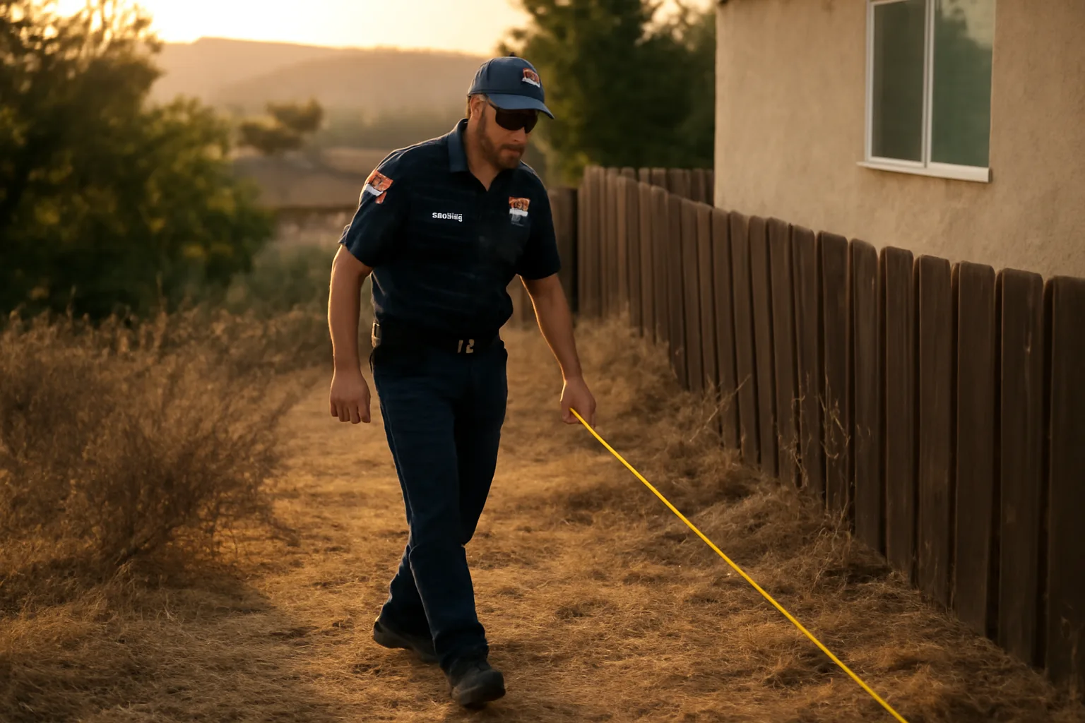
A defensible space inspection is a physical walkthrough of your property, typically done by a local fire department, fire district, or a CAL FIRE-trained inspector, to check whether the space around your home meets fire-clearance standards. The inspector is looking at three things: how close flammable vegetation is to your house, how much dead material (leaves, needles, mulch) has built up, and whether anything (a wood fence, a propane tank, a woodpile) creates a direct fuel path to your walls or roof. In California, the legal reference point is Public Resources Code 4291, which requires 100 feet of defensible space around homes in State Responsibility Areas, broken into two zones: 0-5 feet (the "ember-resistant zone," sometimes called Zone 0) and 5-100 feet (Zones 1 and 2, with different vegetation-spacing rules) [1]. CAL FIRE describes this structure directly: "Defensible space is the buffer you create between a building on your property and the grass, trees, shrubs, or any wildland area that surround it". This is not the same thing as a home insurance underwriting inspection, though the two increasingly overlap. A fire-agency defensible space inspection checks compliance with a public safety code and can result in a citation or a mandated cleanup notice. An insurance inspection (sometimes a drone flyover, sometimes a person with a clipboard) checks whether your property meets an insurer's internal risk model, and the consequence is a non-renewal letter, not a fine. Depending on your county, you might get one, both, or neither in a given year. Check your [fire district's specific defensible space rules here] before assuming statewide numbers apply to your parcel. If you want a structured way to document your property before either type of inspector shows up, that's the actual use case for a survival kit builder, a checklist-driven way to photograph and log the work so you have your own paper trail, separate from whatever the inspector writes down.
Who performs a defensible space inspection and when?
Inspections are usually run by local fire departments, county fire marshals, or CAL FIRE units operating in State Responsibility Areas. Some cities run their own defensible space inspection programs on an annual cycle; others only inspect after a complaint, a red-flag warning season, or a targeted enforcement sweep in high-risk zip codes. CAL FIRE conducts what it calls Defensible Space Inspections in State Responsibility Areas and has stated publicly that compliance rates are far from universal, one of the reasons enforcement and education campaigns keep expanding. If an inspector finds a violation, the usual sequence is a notice of non-compliance, a re-inspection window (commonly 30 to 60 days, though this varies by jurisdiction, so [check your fire district's specific timeline]), and then potential citation or fine if nothing changes. Separately, insurers have started sending their own inspectors, often third-party contractors or drone-imagery vendors, ahead of renewal decisions. This is not a CAL FIRE inspection and doesn't follow PRC 4291 directly, but insurers frequently reference the same 5 ft/30 ft/100 ft zone logic in their underwriting guidelines because it's the most recognized framework in wildfire-prone states. If you got a letter referencing "defensible space" from your insurance company rather than a fire agency, you're dealing with the second kind, and the appeal process (if any) runs through your carrier, not the fire department.
When does the California defensible space law go into effect?
The core 100-foot defensible space requirement under Public Resources Code 4291 has been in effect since 2005, when the state extended clearance from 30 feet to 100 feet around structures in State Responsibility Areas [1]. That part isn't new. What's changed, and what's still being phased in, is the more specific "Zone 0" ember-resistant zone within 5 feet of a structure. California's Board of Forestry and Fire Protection has been developing formal Zone 0 regulations under SB 63 (2023) and related rulemaking, with the Board's own materials targeting adoption and phase-in for structures in the highest-risk areas [2]. As of this writing, the Zone 0 regulation has not been finalized into an enforceable statewide rule with a hard compliance date; it has moved through public comment and draft-regulation stages at the Board of Forestry. Homeowners should check the Board of Forestry and Fire Protection's current rulemaking page directly rather than relying on a fixed date, because the timeline has shifted more than once during the drafting process [2]. This matters for the "what fire codes take effect in 2026" question too: several states, more than California, have building and wildfire code updates scheduled or proposed around 2025-2026 cycles (model code adoption years, insurance-mandated hardening requirements, and updated WUI codes in Colorado and Oregon jurisdictions). None of these are a single national "2026 fire safe law." If you've heard that phrase, it's likely a compression of several separate state and local code cycles landing near the same year. Check your state fire marshal's office for the specific code edition your county has adopted.
Why won't people follow the defensible space law in California?
Nobody has a clean national dataset on defensible space compliance rates, but CAL FIRE's own inspection reporting and post-fire assessments after events like the 2018 Camp Fire and 2021 Dixie Fire repeatedly found homes destroyed despite being in areas with defensible space requirements on the books, which points to enforcement and follow-through gaps rather than the rule being unknown. The honest reasons people skip it aren't mysterious: cost, time, and confusion about what actually counts. Clearing 100 feet of vegetation on a sloped, wooded lot can run into thousands of dollars if you're hiring it out, and doing it yourself takes real weekends, not an afternoon. Renters and lower-income homeowners often can't absorb that cost even when they know the risk. Some homeowners also genuinely don't know the rule applies to them, especially newer residents in a State Responsibility Area who never got a notice. There's also a documentation gap that has nothing to do with laziness. A homeowner might do the clearing work but have no photographic record, no invoice, no dated proof, so when an insurer asks for evidence a year later, they have nothing to show even though the work happened. That gap is exactly what a wildfire defensible space clearing contracts approach or a structured photo log solves, whether you're in California, Washington, or anywhere else with a defensible space mandate.
How to prevent wildfires (what actually reduces risk)
At the individual property level, the two interventions with the most evidence behind them are defensible space clearing and home hardening, meaning the physical materials and details of the structure itself. Ready.gov's wildfire preparedness guidance lists creating defensible space and using fire-resistant building materials as the two primary actions homeowners can take before a fire threat exists. At a landscape level, the causes of wildfire ignition are overwhelmingly human. National Interagency Fire Center and USDA Forest Service data consistently attribute a large majority of wildfire ignitions in the US to human activity (equipment sparks, campfires, debris burning, arson, downed power lines) rather than lightning, especially in the wildland-urban interface where most home losses occur. Reducing that ignition risk means simple things: no debris burning during red-flag warnings, spark arrestors on outdoor equipment, careful campfire extinguishing, and defensible space around outbuildings and propane tanks, more than the main house. The home-hardening side matters as much as the landscaping side. Ember storms, not direct flame contact, destroy most homes in wildfires, according to Institute for Business & Home Safety research on wildfire home losses. That means vent screening, ember-resistant roofing, and closing gaps under decks often matter more than an extra 20 feet of cleared brush. If you haven't looked at your structure itself yet, home hardening priorities and fire-safe landscaping choices next to the house are the two places to start.
How to prepare for a wildfire (before, during, after)
Preparing for a wildfire happens in three phases: the months before fire season, the hours before an evacuation order, and the return afterward. Ready.gov's wildfire page recommends assembling a go-bag, planning two evacuation routes, and signing up for local emergency alerts well before any fire starts. Before season starts: clear defensible space per your local rules, harden vents and eaves, clean gutters of dry leaves, and move firewood piles at least 30 feet from structures. Photograph your property and possessions now, not during an evacuation, because insurance claims after a loss move faster with dated proof of what existed and what condition it was in. During an active threat: follow evacuation orders immediately when issued; don't wait for a visual confirmation of flames. Close all windows and doors, leave lights on so your house is visible through smoke, and move flammable outdoor furniture and doormats inside or away from the structure if you have time and it's safe to do so. After a fire, even if your home survived: document everything before touching anything, because smoke damage claims and defensible space compliance re-checks both depend on photo evidence of pre- and post-fire conditions. This is the exact gap the $99 one-time Wildfire Insurance Survival Kit is built for: a structured way to log defensible space work, property photos, and inventory documentation so you're not scrambling to remember what you did six months before a fire, or trying to prove compliance to an insurer after the fact. It doesn't file claims for you; it just gives you the paperwork trail to send them yourself.
How to prevent forest fires and avoid forest fires (same question, different phrasing)
"Preventing forest fires" and "preventing wildfires" get asked as if they're different questions, but the prevention actions are identical: eliminate human ignition sources and reduce the fuel available to burn. Smokey Bear's federal fire prevention campaign, run jointly by the USDA Forest Service and the National Association of State Foresters, has centered on exactly this since 1944: campfire safety, vehicle spark control, and responsible debris burning [3]. The specific behaviors that matter most: fully drown and stir campfires until cold to the touch, don't drive or park on dry grass (catalytic converters can ignite it), avoid outdoor burning during red-flag warning days, and maintain chainsaws and mowers with proper spark arrestors. Most state forestry agencies, including CAL FIRE, issue burn permits with seasonal restrictions specifically because debris burning is one of the most common preventable ignition sources. On a property level, "avoiding" forest fire damage is really the defensible space and hardening conversation again: reduce fuel continuity between wildland vegetation and your structure, because that continuity is what lets a forest fire become a home fire. If your property backs directly onto wildland, the defensible space zone breakdown is the place to understand exactly what CAL FIRE and most Western states mean by Zone 0, 1, and 2, since the spacing rules differ by zone and slope.
What fire safe codes take effect for homes in 2026?
There isn't one single 2026 fire code. What exists is a set of separate state and local rulemaking processes that happen to be converging around 2025-2026 adoption windows. California's Board of Forestry and Fire Protection has been actively drafting the Zone 0 ember-resistant zone regulation under SB 63 authority, with public comment periods extending across 2024 and 2025 [2]. The exact enforceable date for Zone 0, and which structures it will initially apply to (new construction first, versus retrofits on existing homes), should be confirmed directly on the Board's rulemaking page rather than assumed from secondhand reporting, because the schedule has moved. Separately, many jurisdictions adopt updated International Wildland-Urban Interface Code (IWUIC) or International Building Code editions on multi-year cycles, and some county-level adoptions land in 2025 or 2026 simply because that's when their normal update cycle falls, not because of a new statewide wildfire law. Colorado counties, for instance, adopt WUI codes at the local level, and Oregon's statewide Wildfire Hazard Map and defensible space code (SB 762, 2021) has had its own multi-year rollout with revised timelines after public pushback [4]. The practical takeaway: check your specific state fire marshal's office and county building department for what's actually changing where you live in 2026. Don't rely on a single national date, because there isn't one.
Is Santa Barbara safe from fire?
No coastal California city, including Santa Barbara, is meaningfully "safe" from wildfire risk, and Santa Barbara County has direct experience proving it: the 2017 Thomas Fire, at the time the largest wildfire in modern California history, burned into Santa Barbara County and led directly to the deadly Montecito debris flow in January 2018 that killed 23 people, according to Santa Barbara County's own post-disaster reporting [5]. The 2020-2021 Cave and Alisal fires also burned in the county's wildland-urban interface. Santa Barbara's geography, dry chaparral hillsides directly above dense residential neighborhoods, combined with sundowner wind events that can push fire downslope at high speed, is part of why the region has repeatedly appeared in CAL FIRE's highest Fire Hazard Severity Zone maps for the South Coast [1]. Insurance non-renewals have followed accordingly; Santa Barbara has been one of the more visible California markets where homeowners in hillside and wildland-adjacent neighborhoods have reported non-renewal letters in recent years, consistent with statewide trends the California Department of Insurance has tracked. The honest answer for any specific address is to check CAL FIRE's Fire Hazard Severity Zone viewer for that parcel, not to rely on "Santa Barbara" as a single risk category, because risk varies enormously between a flatland downtown property and a hillside home in Montecito or the foothills.
What's the difference between a defensible space inspection and an insurance inspection?
A defensible space inspection checks legal compliance with a fire code (like PRC 4291 in California) and is conducted by a fire agency; failing it can mean a citation or mandated cleanup order. An insurance inspection checks whether your property meets a private company's underwriting risk threshold, and failing it means a non-renewal letter or a coverage denial, not a legal penalty. The two increasingly reference the same physical standards (the 5/30/100-foot zone structure), but they run on separate tracks with separate consequences and separate appeal paths. You cannot use a fire department's defensible space inspection pass to force an insurer to renew your policy, and you cannot dispute an insurer's non-renewal through your local fire marshal's office. They are legally and administratively unconnected, even when they're checking near-identical vegetation clearance. Many homeowners find out about this distinction the hard way, doing the clearing work to satisfy a fire department notice, then getting a non-renewal letter anyway because the insurer's model weighted roof material, distance to hydrants, or slope angle more heavily than vegetation clearance. If you got a non-renewal letter after a neighbor's house fire or a nearby fire at a house, understanding which of the two inspection types you're actually dealing with is the first step to responding correctly.
How do I prepare for a defensible space inspection?
Start by identifying which zone rules apply to your address; California's are 0-5 feet (ember-resistant zone), 5-30 feet (Zone 1, lean and green), and 30-100 feet (Zone 2, reduced fuel), per CAL FIRE's published defensible space guidance. Other states use similar but not identical numbers, so [check your fire district's specific zone distances] before doing the work. Within 5 feet of the structure: remove all dead vegetation, mulch, and stored combustibles (firewood, propane tanks, wood furniture). This is the zone most associated with ember ignition, since embers can travel over a mile ahead of a fire front and ignite anything flammable touching the house itself. From 5 to 30 feet: space trees and shrubs so canopies don't touch, remove ladder fuels (low branches that let ground fire climb into tree crowns), and keep grass mowed to a low height, typically under 4 inches in most jurisdictions' guidance. From 30 to 100 feet (where the parcel allows it): thin trees so crowns are spaced apart, remove dead and downed material, and reduce overall fuel load without necessarily clearing to bare ground. Document all of it with dated photos before the inspection, and keep receipts for any contractor work. This protects you two ways: it speeds up a fire department re-inspection if something gets flagged, and it gives you your own record if an insurer later disputes what condition your property was in.
How can we prevent forest fires as a community, more than a homeowner?
Individual defensible space work matters less when a neighbor's untended lot sits 40 feet away, so community-level prevention depends on shared participation, more than individual compliance. Firewise USA, a National Fire Protection Association program, recognizes communities that organize collective fuel reduction, shared chipper days, and neighborhood-level risk assessments, precisely because fire doesn't respect property lines . Practical community actions: coordinated green-waste pickup days timed before fire season, shared funding or volunteer crews for elderly or low-income neighbors who can't afford clearing costs themselves, and pushing local fire districts for community chipper programs (many California counties already run these seasonally, often free or low-cost). HOAs in wildfire-prone subdivisions increasingly write defensible space maintenance into covenants, which sounds bureaucratic but closes the exact compliance gap that individual enforcement misses. Reporting matters too: most fire departments take anonymous tips about severely overgrown adjacent lots, and in many jurisdictions an unmaintained lot next to occupied structures can trigger a nuisance abatement process separate from PRC 4291 enforcement. If you're organizing anything at the community level, the "only you can prevent wildfires" campaign history is worth understanding, since it's the messaging framework most fire-prevention outreach in the US still borrows from.
Frequently asked questions
When does the California defensible space law go into effect?
The core 100-foot defensible space requirement under Public Resources Code 4291 has applied since 2005. The newer "Zone 0" 5-foot ember-resistant rule, developed under SB 63, is still in the Board of Forestry and Fire Protection's rulemaking process as of this writing, with no single finalized statewide enforcement date yet, so check the Board's rulemaking page directly [3].
Why won't people follow the defensible space law in California?
Mostly cost, time, and lack of notice, not defiance. Clearing 100 feet of vegetation on a large or sloped lot can cost thousands if hired out, and CAL FIRE's post-fire assessments have repeatedly found non-compliant properties even in areas with the law clearly in effect, pointing to enforcement gaps as much as awareness gaps [2].
How do I prevent wildfires around my own home?
Combine defensible space clearing (100 feet where possible, prioritizing the 5-foot ember zone) with home hardening: ember-resistant vents, non-combustible roofing, and closing gaps under decks. Ready.gov lists these two actions as the primary homeowner-level wildfire prevention steps, since most homes ignite from embers, not direct flame [4].
How do I prepare for a wildfire evacuation?
Build a go-bag, plan two evacuation routes, and register for local emergency alerts before fire season starts, per Ready.gov guidance [4]. Photograph your home and belongings now for insurance purposes. During an active order, leave immediately rather than waiting for visual flame confirmation.
How can we prevent forest fires from starting in the first place?
Most ignitions are human-caused: campfires, equipment sparks, and debris burning. Fully drown campfires, avoid parking on dry grass, follow local burn-permit restrictions, and use spark arrestors on outdoor equipment. The Smokey Bear campaign, run by USDA Forest Service and state foresters since 1944, centers on exactly these behaviors [5].
What fire safe codes take effect for homes in 2026?
There's no single national 2026 fire code. California's Zone 0 ember-zone rule is still in Board of Forestry rulemaking with a shifting timeline [3]. Other 2025-2026 changes are local WUI code adoption cycles in states like Colorado and Oregon. Check your county building department and state fire marshal for your specific timeline.
Is Santa Barbara safe from fire?
No. Santa Barbara County experienced the 2017 Thomas Fire and the resulting 2018 Montecito debris flow that killed 23 people, plus later fires like the 2020 Cave Fire [7]. Hillside and wildland-adjacent neighborhoods sit in CAL FIRE's higher Fire Hazard Severity Zones; check the parcel-specific zone rather than assuming citywide risk.
What is the difference between a defensible space inspection and an insurance inspection?
A defensible space inspection checks legal compliance with a fire code and is run by a fire agency; failing it risks a citation. An insurance inspection checks a private insurer's underwriting model and failing it risks non-renewal. They use similar vegetation-clearance standards but run on completely separate legal and appeal tracks.
What are the defensible space zones in California?
CAL FIRE defines three zones: 0-5 feet (ember-resistant zone, keep essentially clear of combustibles), 5-30 feet (Zone 1, space plants and remove ladder fuels), and 30-100 feet (Zone 2, thin vegetation and remove dead material) [2]. Exact distances and enforcement details vary by local fire district.
Who conducts a defensible space inspection?
Usually a local fire department, county fire marshal, or CAL FIRE unit in State Responsibility Areas. Some run annual inspection cycles; others inspect only after a complaint or during targeted red-flag-season enforcement. Insurance-related inspections are separate and typically run by third-party contractors or drone-imagery vendors hired by the carrier.
What happens if I fail a defensible space inspection?
Typically you get a written notice of non-compliance and a re-inspection window, often 30 to 60 days depending on the jurisdiction, to fix the problem before a citation or fine is issued. This process is set by your local fire district, so confirm the exact timeline with them rather than assuming a statewide standard.
Does clearing defensible space guarantee my insurance stays active?
No. Defensible space compliance satisfies a fire code, not an insurer's underwriting model. Insurers also weigh roof material, slope, distance to hydrants, and regional wildfire history. Documenting your defensible space work with dated photos and receipts helps your case, but it doesn't legally obligate an insurer to renew coverage.
Sources
- California Legislative Information, Public Resources Code Section 4291: 100-foot defensible space requirement and its two-zone structure in State Responsibility Areas
- California Board of Forestry and Fire Protection, Zone 0 rulemaking: Status of the Zone 0 ember-resistant zone regulation and its ongoing rulemaking timeline under SB 63
- USDA Forest Service and Smokey Bear campaign history: Federal wildfire prevention campaign focus on human-caused ignition behaviors since 1944
- Santa Barbara County, Thomas Fire and Montecito Debris Flow recovery information: 2017 Thomas Fire and the January 2018 Montecito debris flow that killed 23 people
- National Fire Protection Association, Firewise USA: Community-level wildfire risk reduction program recognizing collective neighborhood fuel-reduction efforts